
Table Rock Ultras 2016 - 50K
ITRA
 49.3 km
1650 m
1650 m
49.3 km
1650 m
1650 m

GPX
20
PDF
Profil
Partager
3D
Favoris
Avis
J'aime
Morganton (US) (US)
Kilomètre effort
Plus longue montée
Plus longue descente
65
460 m
1000 m
Altitude max
Altitude min
Indice de qualité
1181 m
348 m
 1pt/9m
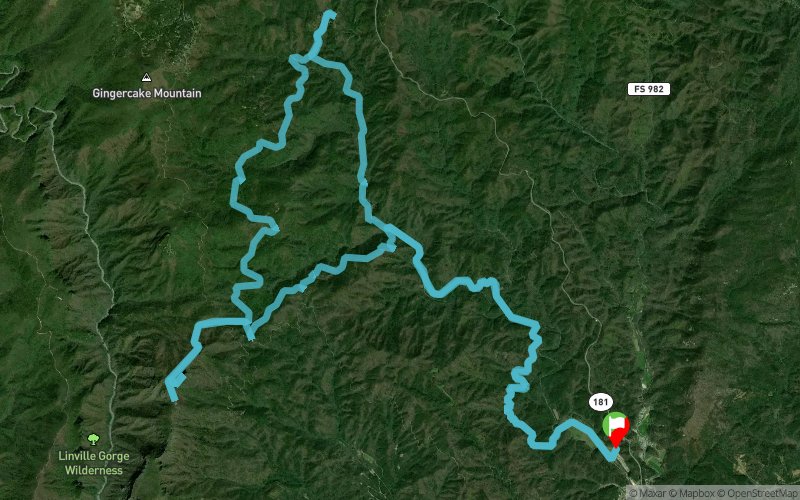
Starting and finishing at Steele Creek Park and Campground, you'll quickly head into the woods for some creek crossing, single-track running, and climbing as you make your way to the summit of Table Rock Mountain where, weather permitting, you'll enjoy an awesome view of the Linville Gorge. When you're done admiring the view, you'll head back to the finish, enjoying a lot of downhill along the way.
En voir plus... En voir moins...

Départ
Distance
0 km
Altitude
360 m
D+
0 m
D-
0 m
49.3 km
1650 m
1650 m
Arrivée
Distance
49.3 km
Altitude
360 m
D+
1650 m
D-
1650 m
Cliquez sur un point d'intérêt pour l'afficher sur la carte
Avis et chronos
Ajouter une trace
Table Rock Ultras 2016 - 50K

Numéro de trace : 23901
Lien vers la trace :
https://tracedetrail.fr/fr/trace/23901
Connectez-vous pour insérer cette trace sur votre site web
 Trace de Trail