
Bigfoot Endurance Runs 2017 - Bigfoot 200
ITRA
 300.9 km
11390 m
11930 m
300.9 km
11390 m
11930 m

GPX
14
PDF
Profile
Share
3D
Favorites
Reviews
Like
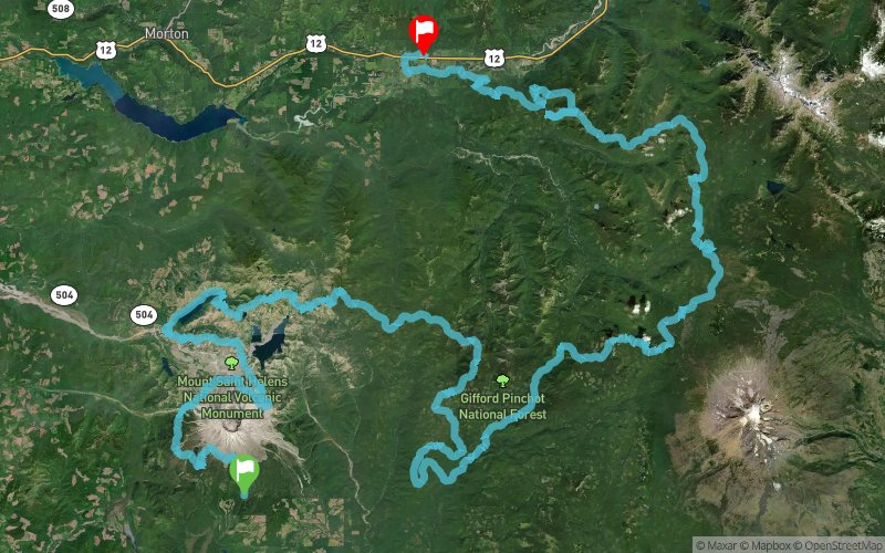
Cougar (US) Randle (US)
Effort kilometer
Longest ascent
Longest descent
414
1200 m
1530 m
Max. elevation
Min. elevation
Quality index
1777 m
266 m
 1pt/35m
The Bigfoot 200 is the first ever point to point 200+ mile race in the United States. The Bigfoot 200 is completely original from start to finish. Runners will explore such varied terrain as the otherworldly Volcanic Mount St. Helens (erupted in 1980), long mountaintop ridge lines with stunning forest, mountain and lake views, deep old growth forests as green and thick as a rainforest, misty mountain tops, cross countless streams and rivers and finally a long ridge line with views of the most massive mountains in the Cascade Range and into Randle, WA on their way to completing this massive, life changing event.
En voir plus... En voir moins...

Start
Distance
0 km
Altitude
813 m
D+
0 m
D-
0 m
300.9 km
11390 m
11924 m
Finish
Distance
300.9 km
Altitude
276 m
D+
11390 m
D-
11924 m
Click on a point of interest to display it on the map
Reviews and times
Add a track
Bigfoot Endurance Runs 2017 - Bigfoot 200

Track number : 43945
Link to track :
https://tracedetrail.fr/en/trace/43945
Log in to insert this track on your website
 Trace de Trail