
Table Rock Ultras 2016 - 50K
ITRA
 49.3 km
1650 m
1650 m
49.3 km
1650 m
1650 m

GPX
20
PDF
Profile
Share
3D
Favorites
Reviews
Like
Morganton (US) (US)
Effort kilometer
Longest ascent
Longest descent
65
460 m
1000 m
Max. elevation
Min. elevation
Quality index
1181 m
348 m
 1pt/9m
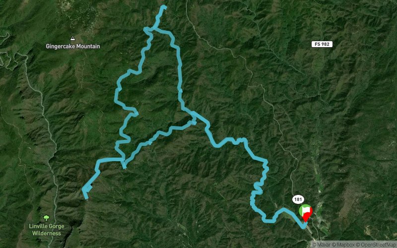
Starting and finishing at Steele Creek Park and Campground, you'll quickly head into the woods for some creek crossing, single-track running, and climbing as you make your way to the summit of Table Rock Mountain where, weather permitting, you'll enjoy an awesome view of the Linville Gorge. When you're done admiring the view, you'll head back to the finish, enjoying a lot of downhill along the way.
En voir plus... En voir moins...

Start
Distance
0 km
Altitude
360 m
D+
0 m
D-
0 m
49.3 km
1650 m
1650 m
Finish
Distance
49.3 km
Altitude
360 m
D+
1650 m
D-
1650 m
Click on a point of interest to display it on the map
Reviews and times
Add a track
Table Rock Ultras 2016 - 50K

Track number : 23901
Link to track :
https://tracedetrail.fr/en/trace/23901
Log in to insert this track on your website
 Trace de Trail