Afficher la carte
PARCOURS OFFICIEL
Trail del Moscato 2018- Lavorare Stanca - 54 km


 Santo Stefano Belbo (IT)


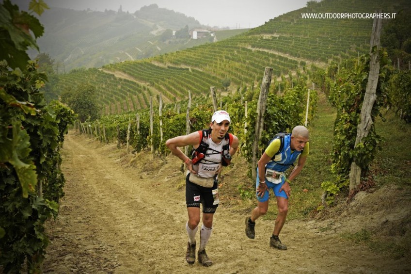
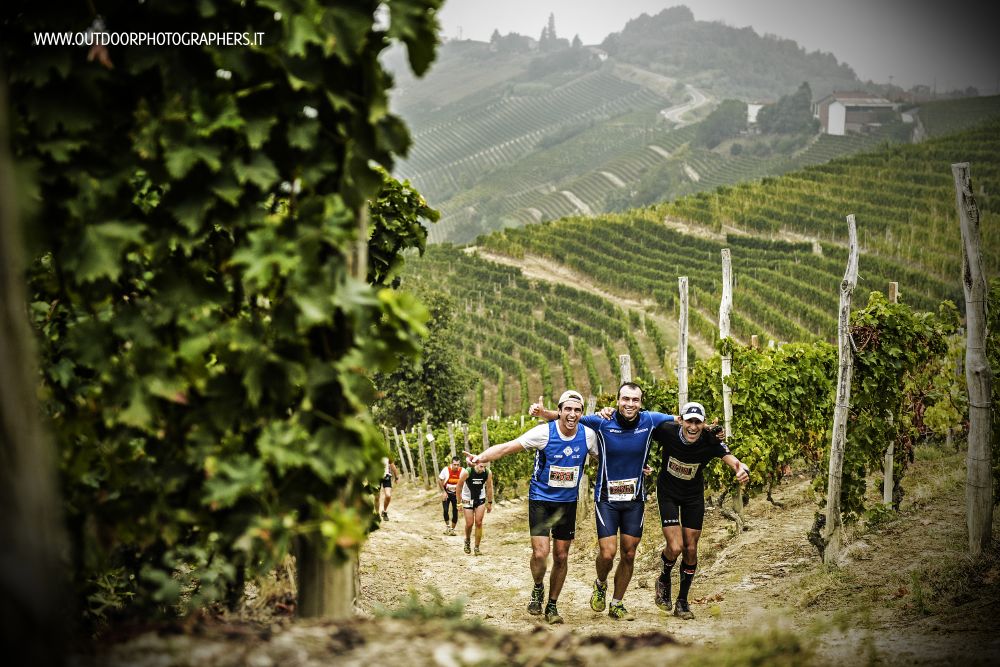
International sports event RUNNING OUTDOOR through the magnificent hills of LANGHE - ITALY - UNESCO WORLD HERITAGE SITE thanks to the exceptional value of the culture of wine Moscato, Barolo and Barbaresco, which over the centuries has shaped the land.
Wine, Truffles and fabulous scenery are waiting athletes and walkers from all over the world to match the outdoor sports to the discovery of the territory, landscapes and culture of gourmet food and wine .
It is a running race of Trail Running entirely on dirt road through the hills of Moscato, Pavese’s paths, vineyards and woods in the municipalities of S. Stefano Belbo and Castiglione Tinella – ITALY -
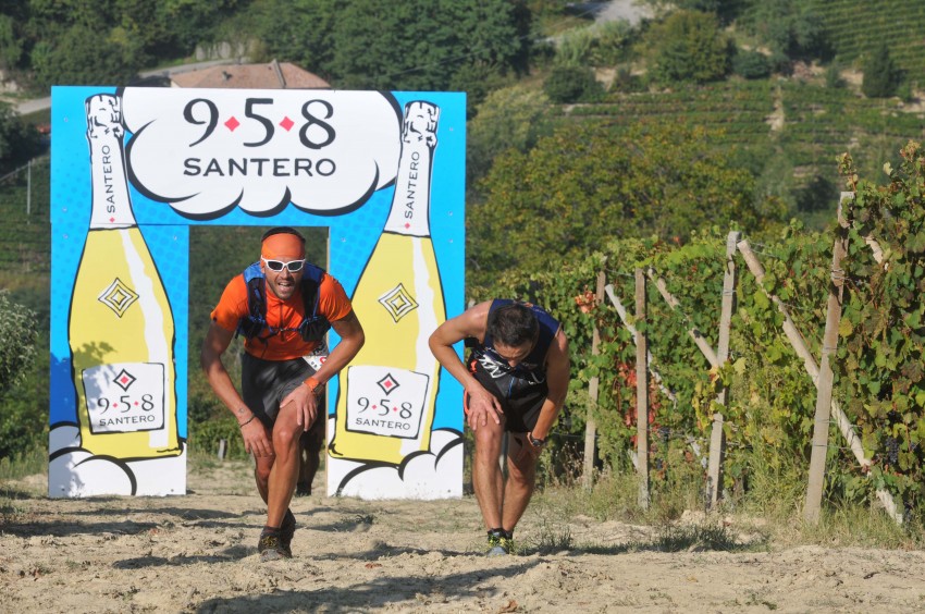
- September 24- 3 competitive RACES –
- 54 Km “Lavorare Stanca” - 2800 mt positive altitude / start at 07.30 am - 96% off road
- 21 Km “ Paesi Tuoi” - 1100 mt positive altitude / start at 09.30 am - 96% off road
- 10 Km “Sali Scendi” - 650 mt positive altitude / start at 10.00 am- offroad e asphalt
The event also provides other three proposals:
- NORDIC WALKING - (10 km -21 km) – start at 10.15
- WALK WINE TOURISM - start at 10.30 through hills and farmhouses in order to taste wine, truffles and local products.
- KIDS FUN RUN - Race 2 km for children till 13 years
THE “TRAIL del MOSCATO” of 54 KM is on the list of Qualifying races for entry to “Ultra-Trail du Mont-Blanc®” 2018. Is a race of Grand Prix IUTA Ultratrail 2017
Table des passages
| Cumul | Intermédiaire | |||||||
|---|---|---|---|---|---|---|---|---|
| Passage | Description | Alt. | Dist. | D+ | D- | Dist. | D+ | D- |
 Compétition organisée le 23/09/2018
Trace n°36884
Seuil de dénivelé : 3 m Seuil de distance : 0 m Lissage : Non Origine des altitudes : GPS
Seuil de dénivelé : 3 m Seuil de distance : 0 m Lissage : Non Origine des altitudes : GPS
Boucle
Terrain dominant : Chemin
Alti. max. : 612 m
Alti. moyenne : 355 m
Alti. min. : 159 m
+ longue montée : 330 m
+ longue descente : 250 m
Terrain dominant : Chemin
Alti. max. : 612 m
Alti. moyenne : 355 m
Alti. min. : 159 m
+ longue montée : 330 m
+ longue descente : 250 m
Plus d'outils
Créer une page de roadbook
Carte et profil sur votre site web
Attention ! En insérant une carte Trace de Trail sur votre site web, vous vous engagez à ne masquer aucun élément du module (liens vers Trace de Trail ou bannière Trail Connect), que ce soit en utilisant l'iframe ou le widget.
Ajouter une réalisation
Valider
Ajoutez une réalisation pour partager votre chrono et détailler les conditions que vous avez recontrées lors de votre sortie trail !
Ajouter un commentaire
Valider
Afficher les infos
Ajouter une trace


