Show the map
Evaluated Track - ITRA
Morenic Trail 2022
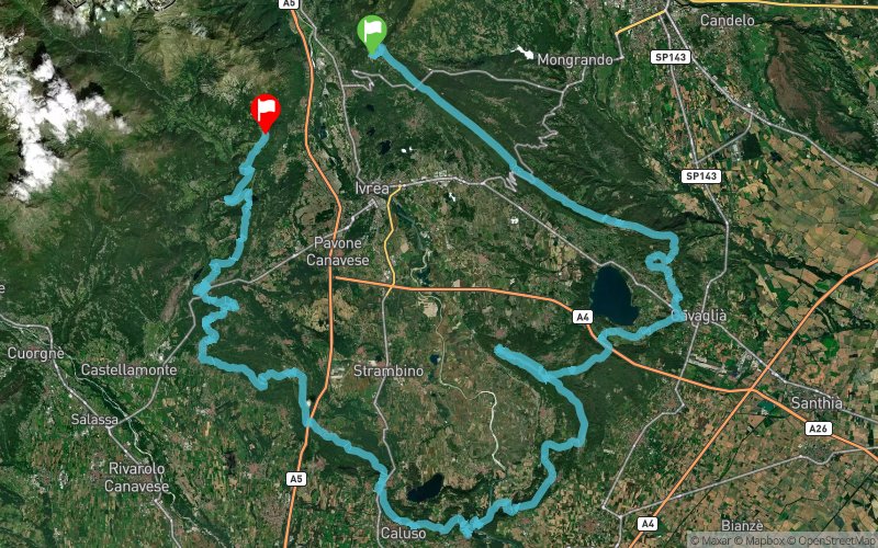


 Andrate (IT)
 Brosso (IT)


Points of Interest table
| Accum. | Intermediary | |||||||
|---|---|---|---|---|---|---|---|---|
| POI | Description | Alt. | Dist. | D+ | D- | Dist. | D+ | D- |
 Competition organized on 10/05/2019
Trace n°97722
Ascent threshold : 3 m Distance threshold : 30 m Smoothing : Yes Origin of altitudes : MNT Google
Ascent threshold : 3 m Distance threshold : 30 m Smoothing : Yes Origin of altitudes : MNT Google
Crossing
Dominant terrain : Footpath
Max alti. : 934 m
Avg alti. : 451 m
Min alti. : 210 m
Longest ascent : 520 m
Longest descent : 1820 m
Dominant terrain : Footpath
Max alti. : 934 m
Avg alti. : 451 m
Min alti. : 210 m
Longest ascent : 520 m
Longest descent : 1820 m
Elevation profile
More tools
Create a new roadbook page
Map and track on your website
Warning ! When you insert a Trace de Trail map on your website, you agree not to hide any element of the module (links to Trail Trail or Trail Connect banner)
Add a realisation
Validate
Add a realisation to share your chrono and describe the conditions that you encountered during you trail running !
Add a comment
Validate
Admin - Trace de Trail
18/09/19, 20:55:22
Bonjour, Merci de ne laisser en public qu'une unique trace pour la même épreuve d'une compétition : https://tracedetrail.com/fr/accueil/help/alire
18/09/19, 20:55:22
Bonjour, Merci de ne laisser en public qu'une unique trace pour la même épreuve d'une compétition : https://tracedetrail.com/fr/accueil/help/alire
Show the infos
Add a track


