Show the map
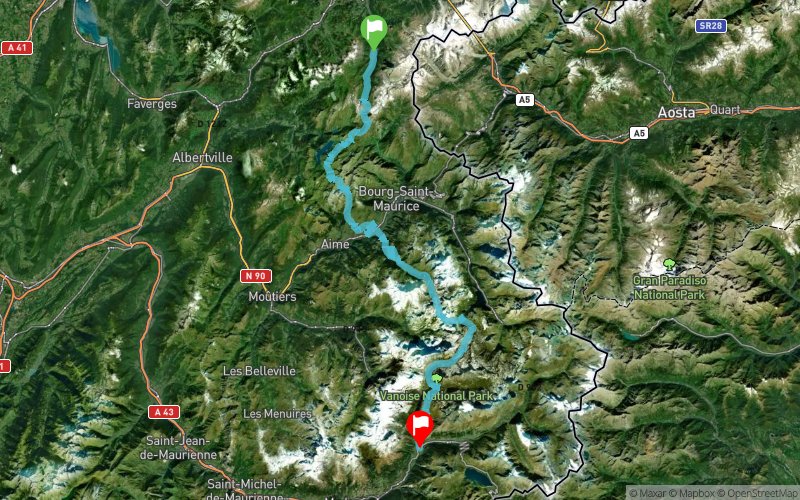
Col de la Sauce - Col du Bresson - Landry - Col du Palet - Col de la Leisse - Plan du Lac


123.9 km
6400 m
6240 m
 Les Contamines-Montjoie (74)
 Termignon (73)
 Points of Interest table
| Accum. | Intermediary | |||||||
|---|---|---|---|---|---|---|---|---|
| POI | Description | Alt. | Dist. | D+ | D- | Dist. | D+ | D- |
 Event off organized on 07/30/2019
Trace n°94618
Ascent threshold : 3 m Distance threshold : 30 m Smoothing : Yes Origin of altitudes : MNT Aster GDEM
Ascent threshold : 3 m Distance threshold : 30 m Smoothing : Yes Origin of altitudes : MNT Aster GDEM
Crossing
Dominant terrain : Footpath
Max alti. : 2766 m
Avg alti. : 1848 m
Min alti. : 733 m
Longest ascent : 1540 m
Longest descent : 1900 m
Dominant terrain : Footpath
Max alti. : 2766 m
Avg alti. : 1848 m
Min alti. : 733 m
Longest ascent : 1540 m
Longest descent : 1900 m
Elevation profile
More tools
Create a new roadbook page
Map and track on your website
Warning ! When you insert a Trace de Trail map on your website, you agree not to hide any element of the module (links to Trail Trail or Trail Connect banner)
Add a realisation
Validate
Add a realisation to share your chrono and describe the conditions that you encountered during you trail running !
Add a comment
Validate
Show the infos
Add a track


