Show the map
Neuville - Lyon - St-Symphorien-d'Ozon - Vienne - Condrieu
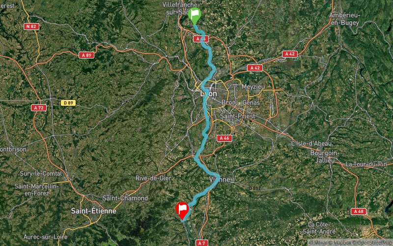


81.4 km
140 m
170 m
 Trévoux (01)
 Chavanay (42)
 Points of Interest table
| Accum. | Intermediary | |||||||
|---|---|---|---|---|---|---|---|---|
| POI | Description | Alt. | Dist. | D+ | D- | Dist. | D+ | D- |
Trace n°92878
Ascent threshold : 5 m Distance threshold : 50 m Smoothing : Yes Origin of altitudes : MNT IGN
Ascent threshold : 5 m Distance threshold : 50 m Smoothing : Yes Origin of altitudes : MNT IGN
Crossing
Dominant terrain : Path
Max alti. : 194 m
Avg alti. : 160 m
Min alti. : 139 m
Longest ascent : 40 m
Longest descent : 50 m
Route completed by the author : No
Dominant terrain : Path
Max alti. : 194 m
Avg alti. : 160 m
Min alti. : 139 m
Longest ascent : 40 m
Longest descent : 50 m
Route completed by the author : No
Elevation profile
More tools
Create a new roadbook page
Map and track on your website
Warning ! When you insert a Trace de Trail map on your website, you agree not to hide any element of the module (links to Trail Trail or Trail Connect banner)
Add a realisation
Validate
Add a realisation to share your chrono and describe the conditions that you encountered during you trail running !
Add a comment
Validate
Admin - Trace de Trail
03/02/20, 22:30:32
Bonjour, Merci de renommer votre trace et de la classer en compétition avant de la placer en public.
03/02/20, 22:30:32
Bonjour, Merci de renommer votre trace et de la classer en compétition avant de la placer en public.
Show the infos
Add a track


