Route 21 - Le camp de César
Add to my favorites

Route opened
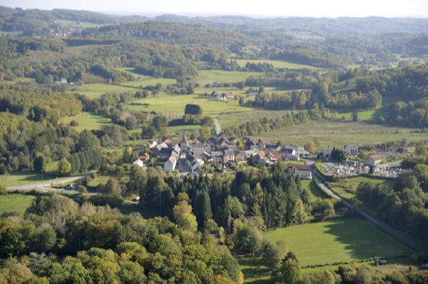
Une découverte des chemins de Saint-Eloi avant un retour par la colline dite du Camp de César.
The characteristics of the route.
Saint-Éloi (23)
- Distance 6.4 km
- Elevation gain 130 m
- Elevation lost 130 m
- Min. elevation 523 m
- Max. elevation. 623 m
- Duration (depending on pace) 2h
- Marking yellow
Add your time and share your feelings


Follow us on
the digital trails
the digital trails


![]()
Info & contacts :
Communauté d'Agglomération du Grand Guéret
Service Sports de nature
Tel : +33(0)5 55 41 04 48
contact@sportsnature-montsdegueret.com


OK
Annuler