Show the map
Les Bois - Villette - Montagne de la Biolle
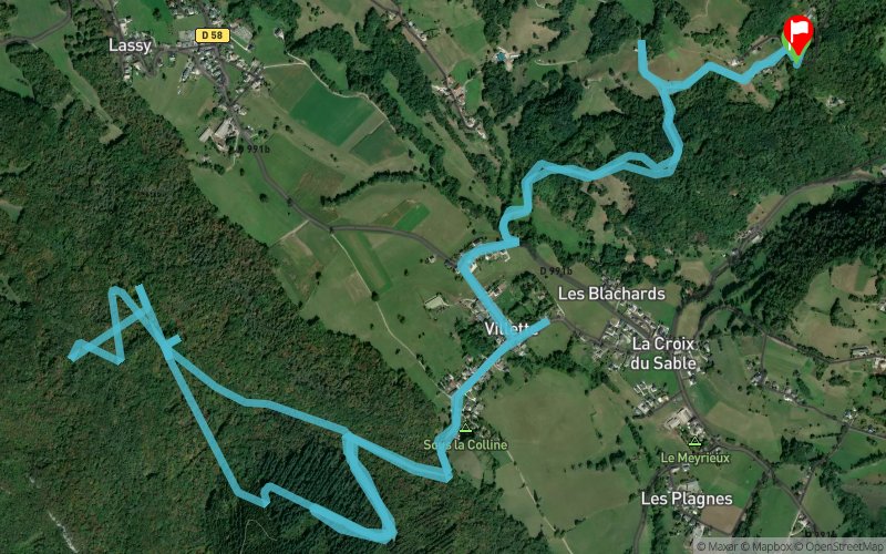


12.4 km
600 m
670 m
 Saint-Germain-la-Chambotte (73)
 Saint-Germain-la-Chambotte (73)
 Points of Interest table
| Accum. | Intermediary | |||||||
|---|---|---|---|---|---|---|---|---|
| POI | Description | Alt. | Dist. | D+ | D- | Dist. | D+ | D- |
Trace n°89078
Ascent threshold : 3 m Distance threshold : 0 m Smoothing : No Origin of altitudes : TrailConnect iOS (baro) - GPS
Ascent threshold : 3 m Distance threshold : 0 m Smoothing : No Origin of altitudes : TrailConnect iOS (baro) - GPS
Loop
Dominant terrain :
Max alti. : 731 m
Avg alti. : 500 m
Min alti. : 352 m
Longest ascent : 200 m
Longest descent : 230 m
Route completed by the author : Yes
Dominant terrain :
Max alti. : 731 m
Avg alti. : 500 m
Min alti. : 352 m
Longest ascent : 200 m
Longest descent : 230 m
Route completed by the author : Yes
Elevation profile
More tools
Create a new roadbook page
Map and track on your website
Warning ! When you insert a Trace de Trail map on your website, you agree not to hide any element of the module (links to Trail Trail or Trail Connect banner)
Add a realisation
Validate
Add a realisation to share your chrono and describe the conditions that you encountered during you trail running !
Add a comment
Validate
Show the infos
Add a track


