
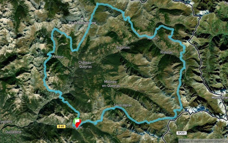
Col de Bramousse - Col de Furfande - Col de Péas - Col Vieux - Col des Estronques
ROUTE TESTED BY THE AUTHOR
 106.7 km
8060 m
8060 m
106.7 km
8060 m
8060 m
GPX
3
PDF
Profile
Share
3D
Favorites
Reviews
Like
Ceillac (05) Ceillac (05)
Effort kilometer
Longest ascent
Longest descent
187
1300 m
1330 m
Max. elevation
Min. elevation
Quality index
2880 m
1200 m
 1pt/105m
Start
Distance
0 km
Altitude
1644 m
D+
0 m
D-
0 m
106.7 km
8060 m
8060 m
Finish
Distance
106.7 km
Altitude
1644 m
D+
8060 m
D-
8060 m
Click on a point of interest to display it on the map
Reviews and times
Add a track
Col de Bramousse - Col de Furfande - Col de Péas - Col Vieux - Col des Estronques

Track number : 88604
Link to track :
https://tracedetrail.fr/en/trace/88604
Log in to insert this track on your website
 Trace de Trail