Show the map
Thumeries - Forêt de Phalempin - Leforest - Moncheaux
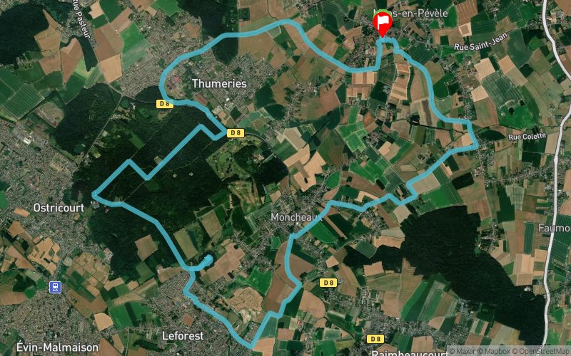


21.5 km
200 m
200 m
 Mons-en-Pévèle (59)
 Mons-en-Pévèle (59)
 Points of Interest table
| Accum. | Intermediary | |||||||
|---|---|---|---|---|---|---|---|---|
| POI | Description | Alt. | Dist. | D+ | D- | Dist. | D+ | D- |
Trace n°87807
Ascent threshold : 0 m Distance threshold : 30 m Smoothing : Yes Origin of altitudes : MNT IGN
Ascent threshold : 0 m Distance threshold : 30 m Smoothing : Yes Origin of altitudes : MNT IGN
Loop
Dominant terrain : Path
Max alti. : 91 m
Avg alti. : 49 m
Min alti. : 27 m
Longest ascent : 100 m
Longest descent : 60 m
Route completed by the author : Yes
Dominant terrain : Path
Max alti. : 91 m
Avg alti. : 49 m
Min alti. : 27 m
Longest ascent : 100 m
Longest descent : 60 m
Route completed by the author : Yes
Elevation profile
More tools
Create a new roadbook page
Map and track on your website
Warning ! When you insert a Trace de Trail map on your website, you agree not to hide any element of the module (links to Trail Trail or Trail Connect banner)
Add a realisation
Validate
Add a realisation to share your chrono and describe the conditions that you encountered during you trail running !
Add a comment
Validate
Admin - Trace de Trail
04/10/20, 10:59:25
Bonjour, Oui à peine... En France, la méthode de calcul du dénivelé recommandée est le MNT IGN. Je viens de corriger cela. Bonne journée.
04/10/20, 10:59:25
Bonjour, Oui à peine... En France, la méthode de calcul du dénivelé recommandée est le MNT IGN. Je viens de corriger cela. Bonne journée.
Show the infos
Add a track


