Show the map
OFFICIAL ROUTE
Lisarun 53 2019 - Extreme Trail - 42 km
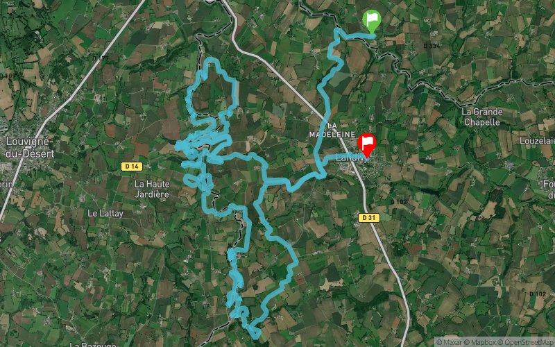


43.4 km
1380 m
1310 m
 Savigny-le-Vieux (50)
 Landivy (53)
 3
3 320
320 Points of Interest table
| Accum. | Intermediary | |||||||
|---|---|---|---|---|---|---|---|---|
| POI | Description | Alt. | Dist. | D+ | D- | Dist. | D+ | D- |
 Competition organized on 05/19/2019
Trace n°87484
Ascent threshold : 0 m Distance threshold : 30 m Smoothing : Yes Origin of altitudes : MNT IGN
Ascent threshold : 0 m Distance threshold : 30 m Smoothing : Yes Origin of altitudes : MNT IGN
Crossing
Dominant terrain : Footpath
Max alti. : 195 m
Avg alti. : 135 m
Min alti. : 97 m
Longest ascent : 200 m
Longest descent : 70 m
Dominant terrain : Footpath
Max alti. : 195 m
Avg alti. : 135 m
Min alti. : 97 m
Longest ascent : 200 m
Longest descent : 70 m
Elevation profile
More tools
Create a new roadbook page
Map and track on your website
Warning ! When you insert a Trace de Trail map on your website, you agree not to hide any element of the module (links to Trail Trail or Trail Connect banner)
Add a realisation
Validate
Add a realisation to share your chrono and describe the conditions that you encountered during you trail running !
Add a comment
Validate
Show the infos
Warning ! This track is only accessible on the day of the competition.
Add a track


