Show the map
Tréviers - Pic St-Loup - Montagne d'Hortus - Rocher du Causse - Crête de Taillade
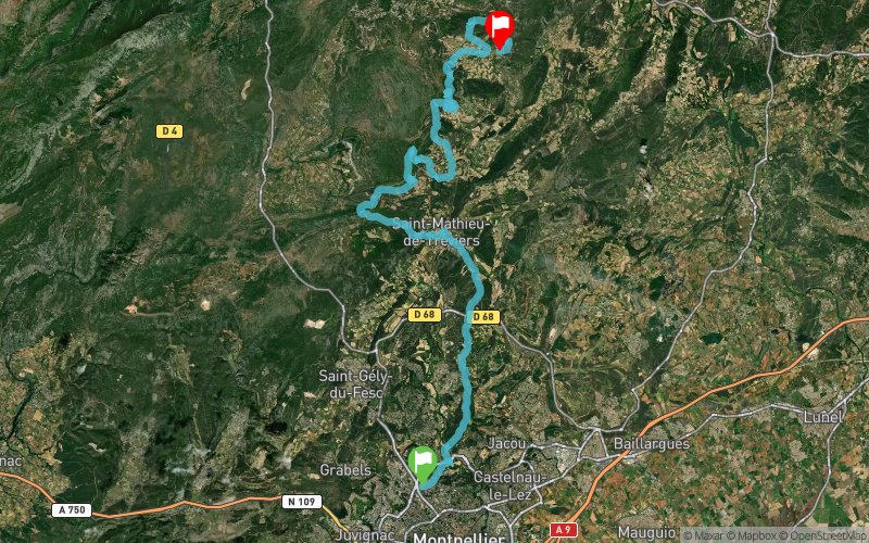


59.7 km
2200 m
2110 m
 Montferrier-sur-Lez (34)
 Claret (34)
 Points of Interest table
| Accum. | Intermediary | |||||||
|---|---|---|---|---|---|---|---|---|
| POI | Description | Alt. | Dist. | D+ | D- | Dist. | D+ | D- |
Trace n°85404
Ascent threshold : 3 m Distance threshold : 30 m Smoothing : No Origin of altitudes : MNT Aster GDEM
Ascent threshold : 3 m Distance threshold : 30 m Smoothing : No Origin of altitudes : MNT Aster GDEM
Crossing
Dominant terrain : Footpath
Max alti. : 624 m
Avg alti. : 210 m
Min alti. : 22 m
Longest ascent : 550 m
Longest descent : 470 m
Route completed by the author : No
Dominant terrain : Footpath
Max alti. : 624 m
Avg alti. : 210 m
Min alti. : 22 m
Longest ascent : 550 m
Longest descent : 470 m
Route completed by the author : No
Elevation profile
More tools
Create a new roadbook page
Map and track on your website
Warning ! When you insert a Trace de Trail map on your website, you agree not to hide any element of the module (links to Trail Trail or Trail Connect banner)
Add a realisation
Validate
Add a realisation to share your chrono and describe the conditions that you encountered during you trail running !
Add a comment
Validate
Show the infos
Add a track


