Show the map
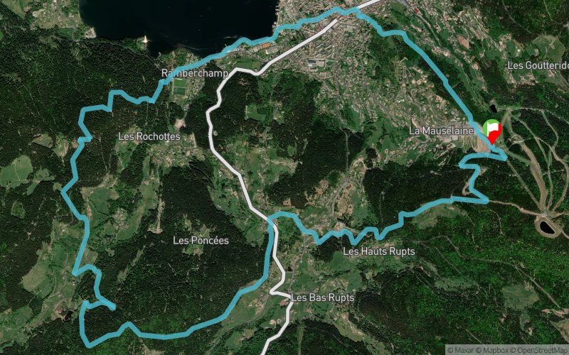
5 La Boucle des Écarts


16.8 km
850 m
850 m

Points of Interest table
Accum. | Intermediary | |||||||
---|---|---|---|---|---|---|---|---|
POI | Description | Alt. | Dist. | D+ | D- | Dist. | D+ | D- |
Trace n°82881
Ascent threshold : 3 m Distance threshold : 30 m Smoothing : No Origin of altitudes : MNT Aster GDEM
Loop
Dominant terrain : Path
Max alti. : 1033 m
Avg alti. : 831 m
Min alti. : 654 m
Longest ascent : 220 m
Longest descent : 280 m
Route completed by the author : No
Dominant terrain : Path
Max alti. : 1033 m
Avg alti. : 831 m
Min alti. : 654 m
Longest ascent : 220 m
Longest descent : 280 m
Route completed by the author : No
Elevation profile

Their last tracks
More tools
Create a new roadbook page
Carte à la Carte IGN
Map and track on your website
Warning ! When you insert a Trace de Trail map on your website, you agree not to hide any element of the module (links to Trail Trail or Trail Connect banner)
Add a realisation
Validate
Add a realisation to share your chrono and describe the conditions that you encountered during you trail running !
Add a comment
Validate
Nearby tracks
0.0 km Rando trail - n°6 Bleu - Trail court de la Vallée des Lacs
22 km
1159 m
1162 m
Gérardmer (88)
0.0 km Rando trail - n° 7 Rouge - Tour de Gérardmer par les Hauts
32.2 km
1543 m
1542 m
Gérardmer (88)
0.0 km La Mauselaine - Le Régit - Le Rainkopf - Metzeral - Le Hohneck - Lac de Longemer
61.8 km
3530 m
3530 m
Gérardmer (88)
0.0 km La Mauselaine - Tête de Grouvelin - Le Hohneck - Lac de Longemer
41.3 km
2150 m
2150 m
Gérardmer (88)
0.0 km La Madelaine - Le Régit - Le Rainkopf - Le Kastelberg - Le Hohneck - Lac de Longemer
41.6 km
2120 m
2130 m
Gérardmer (88)
Show the infos
Add a track