Show the map
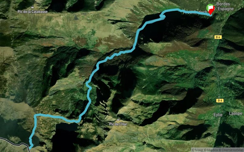
Fréchendech - Pic de Crabère


23.5 km
1900 m
1900 m

Points of Interest table
Accum. | Intermediary | |||||||
---|---|---|---|---|---|---|---|---|
POI | Description | Alt. | Dist. | D+ | D- | Dist. | D+ | D- |
Trace n°77731
Ascent threshold : 3 m Distance threshold : 30 m Smoothing : Yes Origin of altitudes : MNT IGN
Loop
Dominant terrain : Footpath
Max alti. : 2620 m
Avg alti. : 1507 m
Min alti. : 798 m
Longest ascent : 1870 m
Longest descent : 1850 m
Route completed by the author : Yes
Dominant terrain : Footpath
Max alti. : 2620 m
Avg alti. : 1507 m
Min alti. : 798 m
Longest ascent : 1870 m
Longest descent : 1850 m
Route completed by the author : Yes
Elevation profile

Their last tracks
Pont d'Espagne - Pic de Bernat Barrau - Refuge Wallon - Col des Mulets - Lac de Gaube
34.1 km
2550 m
2540 m
Cauterets (65)
More tools
Create a new roadbook page
Carte à la Carte IGN
Map and track on your website
Warning ! When you insert a Trace de Trail map on your website, you agree not to hide any element of the module (links to Trail Trail or Trail Connect banner)
Add a realisation
Validate
Add a realisation to share your chrono and describe the conditions that you encountered during you trail running !
Add a comment
Validate
Nearby tracks
0.8 km Pierre Cabane - Étang d'Araing - Pic de Crabère - Col d'Auarde
26.6 km
2090 m
2090 m
Antras (09)
2.4 km Rochers de Puech - Cap de l'Empaillou - Étang d'Araing - Col de Héréchech
37.7 km
3020 m
3020 m
Sentein (09)
4.9 km Le Bentaillou - Col de Blazy - Col des Morères - Balacet - Cap de l'Empaillou
56.9 km
3950 m
3960 m
Sentein (09)
4.9 km Eylie d'en Haut - Cabane de Bentaillou - Pic de Serre-Haute
18.5 km
1790 m
1780 m
Sentein (09)
5.0 km Bocard d'Eylie - Cap de Pouech - Passage de la Lègne - Pass'Aran
66.3 km
7060 m
7050 m
Sentein (09)
5.1 km Cabane d'haou - Port d'Urets - Pic de Canejan - Le Bentaillou
29.5 km
2730 m
2730 m
Sentein (09)
Show the infos
Add a track