Show the map
Mont Saint-Michel
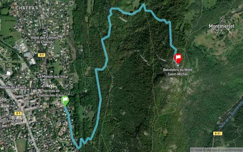


3 km
580 m
10 m
 Challes-les-Eaux (73)
 Challes-les-Eaux (73)
 Points of Interest table
| Accum. | Intermediary | |||||||
|---|---|---|---|---|---|---|---|---|
| POI | Description | Alt. | Dist. | D+ | D- | Dist. | D+ | D- |
Trace n°71037
Ascent threshold : 3 m Distance threshold : 30 m Smoothing : Yes Origin of altitudes : MNT Aster GDEM
Ascent threshold : 3 m Distance threshold : 30 m Smoothing : Yes Origin of altitudes : MNT Aster GDEM
Crossing
Dominant terrain : Footpath
Max alti. : 877 m
Avg alti. : 509 m
Min alti. : 296 m
Longest ascent : 580 m
Longest descent : 10 m
Route completed by the author : Yes
Dominant terrain : Footpath
Max alti. : 877 m
Avg alti. : 509 m
Min alti. : 296 m
Longest ascent : 580 m
Longest descent : 10 m
Route completed by the author : Yes
Elevation profile
More tools
Create a new roadbook page
Map and track on your website
Warning ! When you insert a Trace de Trail map on your website, you agree not to hide any element of the module (links to Trail Trail or Trail Connect banner)
Add a realisation
Validate
Add a realisation to share your chrono and describe the conditions that you encountered during you trail running !
Add a comment
Validate
JeremG
05/06/19, 07:36:11
En effet il faut bien prendre les coupes sinon ça fait vite des détours ^^ Content que ça vous ait plu !
05/06/19, 07:36:11
En effet il faut bien prendre les coupes sinon ça fait vite des détours ^^ Content que ça vous ait plu !
Camille Desseix
04/06/19, 21:57:03
Idee sympa mais en partant de derrière le chateau jusqu'au mont saint michel j ai eu 12km avec strava, surprise du coup ^^ Mais le coin est top a refaire!
04/06/19, 21:57:03
Idee sympa mais en partant de derrière le chateau jusqu'au mont saint michel j ai eu 12km avec strava, surprise du coup ^^ Mais le coin est top a refaire!
Show the infos
Add a track


