Show the map
Saint Max Trail 2018 - SMT16
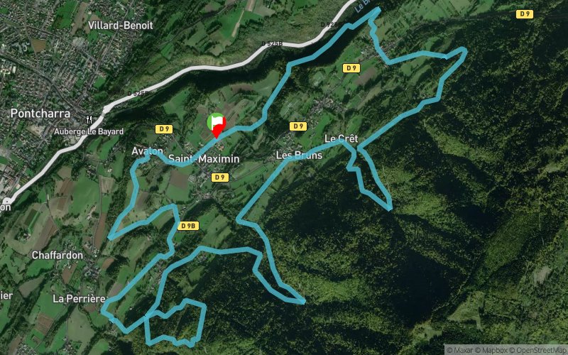


16.1 km
1380 m
1380 m
 Saint-Maximin (38)
 Points of Interest table
| Accum. | Intermediary | |||||||
|---|---|---|---|---|---|---|---|---|
| POI | Description | Alt. | Dist. | D+ | D- | Dist. | D+ | D- |
 Competition organized on 09/30/2018
Trace n°68113
Ascent threshold : 3 m Distance threshold : 30 m Smoothing : No Origin of altitudes : MNT Aster GDEM
Ascent threshold : 3 m Distance threshold : 30 m Smoothing : No Origin of altitudes : MNT Aster GDEM
Loop
Dominant terrain : Path
Max alti. : 710 m
Avg alti. : 489 m
Min alti. : 309 m
Longest ascent : 360 m
Longest descent : 320 m
Dominant terrain : Path
Max alti. : 710 m
Avg alti. : 489 m
Min alti. : 309 m
Longest ascent : 360 m
Longest descent : 320 m
Elevation profile
More tools
Create a new roadbook page
Map and track on your website
Warning ! When you insert a Trace de Trail map on your website, you agree not to hide any element of the module (links to Trail Trail or Trail Connect banner)
Add a realisation
Validate
Add a realisation to share your chrono and describe the conditions that you encountered during you trail running !
Add a comment
Validate
Sylvain_MUGNIER-738
16/09/18, 09:09:53
Trail en "balcon" passant par plusieurs hameaux et exclusivement sur la commune de Saint MAXIMIN. Quelques liaisons sur surface goudronnées.
16/09/18, 09:09:53
Trail en "balcon" passant par plusieurs hameaux et exclusivement sur la commune de Saint MAXIMIN. Quelques liaisons sur surface goudronnées.
Show the infos
Warning ! This track is only accessible on the day of the competition.
Add a track


