Show the map
Le Moine de la Vallée - Les Crêtes de Capucin - Lods
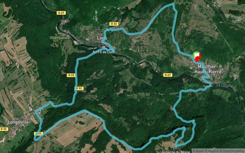


14.3 km
825 m
822 m
 Mouthier-Haute-Pierre (25)
 Points of Interest table
| Accum. | Intermediary | |||||||
|---|---|---|---|---|---|---|---|---|
| POI | Description | Alt. | Dist. | D+ | D- | Dist. | D+ | D- |
Trace n°6690
Ascent threshold : 1 m Distance threshold : 30 m Smoothing : Yes Origin of altitudes : MNT Aster GDEM
Ascent threshold : 1 m Distance threshold : 30 m Smoothing : Yes Origin of altitudes : MNT Aster GDEM
Loop
Dominant terrain : Footpath
Max alti. : 856 m
Avg alti. : 601 m
Min alti. : 368 m
Longest ascent : 305 m
Longest descent : 442 m
Route completed by the author : nc
Dominant terrain : Footpath
Max alti. : 856 m
Avg alti. : 601 m
Min alti. : 368 m
Longest ascent : 305 m
Longest descent : 442 m
Route completed by the author : nc
Elevation profile
More tools
Create a new roadbook page
Map and track on your website
Warning ! When you insert a Trace de Trail map on your website, you agree not to hide any element of the module (links to Trail Trail or Trail Connect banner)
Add a realisation
Validate
Add a comment
Validate
Show the infos
Add a track


