Show the map
Trail des Chamois 2022
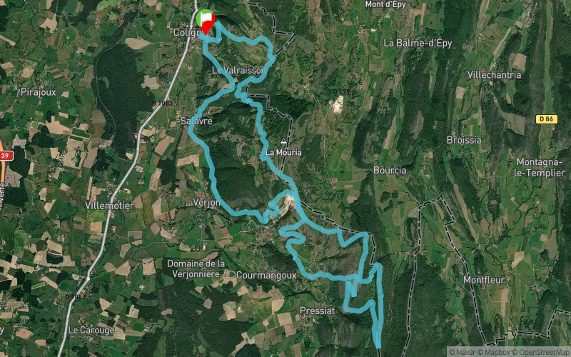


 Coligny (01)
 Points of Interest table
| Accum. | Intermediary | |||||||
|---|---|---|---|---|---|---|---|---|
| POI | Description | Alt. | Dist. | D+ | D- | Dist. | D+ | D- |
 Competition organized on 03/20/2022
Trace n°65959
Ascent threshold : 9 m Distance threshold : 30 m Smoothing : No Origin of altitudes : MNT Aster GDEM
Ascent threshold : 9 m Distance threshold : 30 m Smoothing : No Origin of altitudes : MNT Aster GDEM
Loop
Dominant terrain : Footpath
Max alti. : 655 m
Avg alti. : 434 m
Min alti. : 242 m
Longest ascent : 330 m
Longest descent : 250 m
Dominant terrain : Footpath
Max alti. : 655 m
Avg alti. : 434 m
Min alti. : 242 m
Longest ascent : 330 m
Longest descent : 250 m
More tools
Create a new roadbook page
Map and track on your website
Warning ! When you insert a Trace de Trail map on your website, you agree not to hide any element of the module (links to Trail Trail or Trail Connect banner)
Add a realisation
Validate
Add a realisation to share your chrono and describe the conditions that you encountered during you trail running !
Add a comment
Validate
Admin - Trace de Trail
28/01/19, 22:58:32
Bonjour, merci de classer votre trace en compétition et de la renommer avant de la placer en public.
28/01/19, 22:58:32
Bonjour, merci de classer votre trace en compétition et de la renommer avant de la placer en public.
Show the infos
Add a track


