Show the map
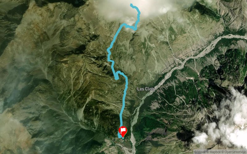
Les Baumes - Lacs de Crupillouse


15.3 km
1410 m
1410 m


Points of Interest table
Accum. | Intermediary | |||||||
---|---|---|---|---|---|---|---|---|
POI | Description | Alt. | Dist. | D+ | D- | Dist. | D+ | D- |
Trace n°64969
Ascent threshold : 3 m Distance threshold : 30 m Smoothing : No Origin of altitudes : MNT Aster GDEM
Loop
Dominant terrain : Footpath
Max alti. : 2657 m
Avg alti. : 1988 m
Min alti. : 1349 m
Longest ascent : 1360 m
Longest descent : 1360 m
Route completed by the author : No
Dominant terrain : Footpath
Max alti. : 2657 m
Avg alti. : 1988 m
Min alti. : 1349 m
Longest ascent : 1360 m
Longest descent : 1360 m
Route completed by the author : No
Elevation profile

Their last tracks
Col de Chavannes - Col du Petit St-Bernard - Col de la Forclaz - Les Contamines-Montjoie
121.6 km
7950 m
8130 m
Courmayeur (IT)
More tools
Create a new roadbook page
Carte à la Carte IGN
Map and track on your website
Warning ! When you insert a Trace de Trail map on your website, you agree not to hide any element of the module (links to Trail Trail or Trail Connect banner)
Add a realisation
Validate
Add a realisation to share your chrono and describe the conditions that you encountered during you trail running !
Add a comment
Validate
Nearby tracks
1.4 km Les Gondoins - Col de Côte Longue - Molines en Champsaur
25.1 km
1820 m
1850 m
Champoléon (05)
3.0 km Les Borels - Col de Côte Longue - Vieux Chaillol - Col de Clémens
27.7 km
2470 m
2470 m
Champoléon (05)
3.0 km Les Borels - Vieux Chaillol - Col de la Pisse - Col de la Vénasque
27.7 km
2470 m
2470 m
Champoléon (05)
3.2 km Les Borels - Orcières-Merlette - Sommet Drouvet - Prapic
33.8 km
1540 m
1250 m
Champoléon (05)
5.6 km Ref. du Pré de la Chaumette - Col de Vallonpierre - Pic de Parières
45.3 km
3713 m
3711 m
Champoléon (05)
Show the infos
Add a track