Show the map
Forêt de Chantilly - La Chaussée - Baillon - Coye-la-Forêt
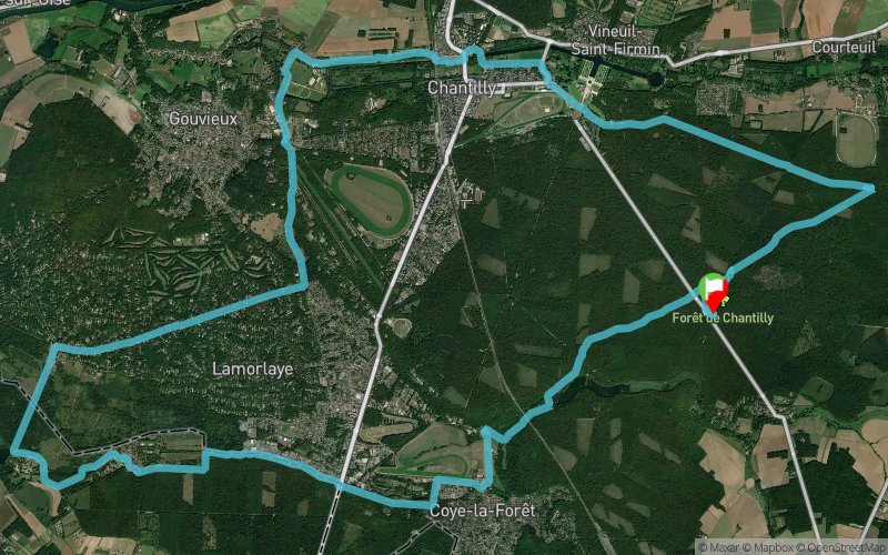


34.2 km
620 m
620 m
 Pontarmé (60)
 Points of Interest table
| Accum. | Intermediary | |||||||
|---|---|---|---|---|---|---|---|---|
| POI | Description | Alt. | Dist. | D+ | D- | Dist. | D+ | D- |
Trace n°62130
Ascent threshold : 3 m Distance threshold : 30 m Smoothing : No Origin of altitudes : MNT Aster GDEM
Ascent threshold : 3 m Distance threshold : 30 m Smoothing : No Origin of altitudes : MNT Aster GDEM
Loop
Dominant terrain : Path
Max alti. : 105 m
Avg alti. : 50 m
Min alti. : 20 m
Longest ascent : 80 m
Longest descent : 70 m
Route completed by the author : Yes
Dominant terrain : Path
Max alti. : 105 m
Avg alti. : 50 m
Min alti. : 20 m
Longest ascent : 80 m
Longest descent : 70 m
Route completed by the author : Yes
Elevation profile
More tools
Create a new roadbook page
Map and track on your website
Warning ! When you insert a Trace de Trail map on your website, you agree not to hide any element of the module (links to Trail Trail or Trail Connect banner)
Add a realisation
Validate
Add a realisation to share your chrono and describe the conditions that you encountered during you trail running !
Add a comment
Validate
fabien2546
09/02/20, 09:41:47
Merci pour la trace ! Cependant, il y a peut-être un peu trop de passages longeant des routes ou pistes cyclables (notamment entre Gouvieux et Coye la Forêt) pour du trail. Sur la fin, j'ai modifié pour longer les étangs, ça rallonge mais c'est un endroit sympa.
09/02/20, 09:41:47
Merci pour la trace ! Cependant, il y a peut-être un peu trop de passages longeant des routes ou pistes cyclables (notamment entre Gouvieux et Coye la Forêt) pour du trail. Sur la fin, j'ai modifié pour longer les étangs, ça rallonge mais c'est un endroit sympa.
Show the infos
Add a track


