Show the map
Grande Traversée des Pyréenées 2018 - Étape 12


38.2 km
2980 m
2540 m
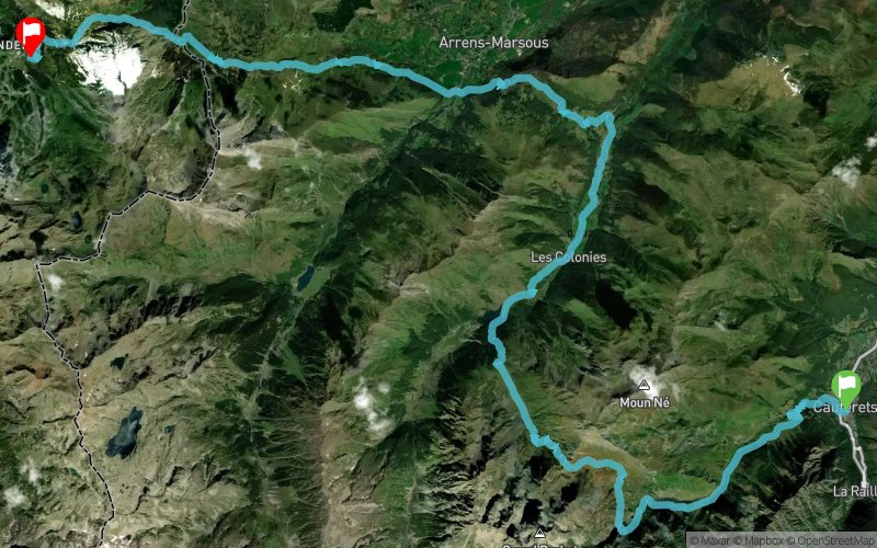
 Cauterets (65)
 Eaux-Bonnes (64)
 Points of Interest table
| Accum. | Intermediary | |||||||
|---|---|---|---|---|---|---|---|---|
| POI | Description | Alt. | Dist. | D+ | D- | Dist. | D+ | D- |
 Event off organized on 07/17/2018
Trace n°61904
Ascent threshold : 3 m Distance threshold : 30 m Smoothing : No Origin of altitudes : MNT Aster GDEM
Ascent threshold : 3 m Distance threshold : 30 m Smoothing : No Origin of altitudes : MNT Aster GDEM
Crossing
Dominant terrain : Path
Max alti. : 2252 m
Avg alti. : 1388 m
Min alti. : 886 m
Longest ascent : 1370 m
Longest descent : 1370 m
Dominant terrain : Path
Max alti. : 2252 m
Avg alti. : 1388 m
Min alti. : 886 m
Longest ascent : 1370 m
Longest descent : 1370 m
Elevation profile
More tools
Create a new roadbook page
Map and track on your website
Warning ! When you insert a Trace de Trail map on your website, you agree not to hide any element of the module (links to Trail Trail or Trail Connect banner)
Add a realisation
Validate
Add a realisation to share your chrono and describe the conditions that you encountered during you trail running !
Add a comment
Validate
Show the infos
Add a track


