Show the map
Evaluated Track - ITRA
Gede Pangrango 2018 - A
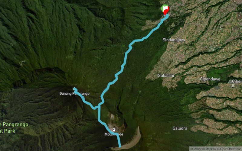


27.2 km
2410 m
2410 m
 Cibodas Office, Gede Pangrango National Park (ID)
 13
13 290
290 Points of Interest table
| Accum. | Intermediary | |||||||
|---|---|---|---|---|---|---|---|---|
| POI | Description | Alt. | Dist. | D+ | D- | Dist. | D+ | D- |
 Competition organized on 12/01/2018
Trace n°59675
Ascent threshold : 3 m Distance threshold : 30 m Smoothing : Yes Origin of altitudes : MNT Aster GDEM
Ascent threshold : 3 m Distance threshold : 30 m Smoothing : Yes Origin of altitudes : MNT Aster GDEM
Loop
Dominant terrain : Path
Max alti. : 2998 m
Avg alti. : 2214 m
Min alti. : 1299 m
Longest ascent : 1710 m
Longest descent : 1620 m
Dominant terrain : Path
Max alti. : 2998 m
Avg alti. : 2214 m
Min alti. : 1299 m
Longest ascent : 1710 m
Longest descent : 1620 m
Elevation profile
More tools
Create a new roadbook page
Map and track on your website
Warning ! When you insert a Trace de Trail map on your website, you agree not to hide any element of the module (links to Trail Trail or Trail Connect banner)
Add a realisation
Validate
Add a realisation to share your chrono and describe the conditions that you encountered during you trail running !
Add a comment
Validate
Admin - Trace de Trail
23/05/18, 20:21:57
Bonjour, Merci de respecter les règles de nommage du site avant de placer vos traces en public : https://tracedetrail.fr/fr/accueil/help/alire
23/05/18, 20:21:57
Bonjour, Merci de respecter les règles de nommage du site avant de placer vos traces en public : https://tracedetrail.fr/fr/accueil/help/alire
Show the infos
Add a track


