Show the map
La Roque - Tour d'Ausseing - Hajaou
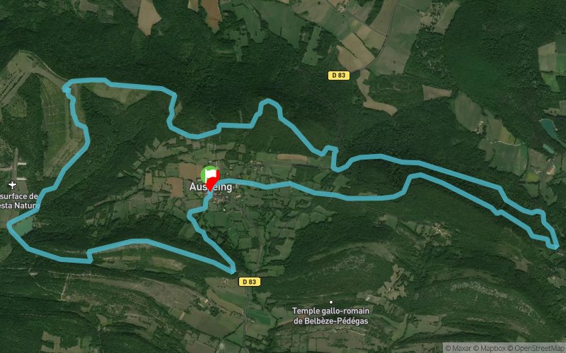


14.9 km
595 m
586 m
 Ausseing (31)
 Points of Interest table
| Accum. | Intermediary | |||||||
|---|---|---|---|---|---|---|---|---|
| POI | Description | Alt. | Dist. | D+ | D- | Dist. | D+ | D- |
Trace n°5616
Ascent threshold : 3 m Distance threshold : 30 m Smoothing : Yes Origin of altitudes : MNT Aster GDEM
Ascent threshold : 3 m Distance threshold : 30 m Smoothing : Yes Origin of altitudes : MNT Aster GDEM
Loop
Dominant terrain : Footpath
Max alti. : 596 m
Avg alti. : 490 m
Min alti. : 342 m
Longest ascent : 212 m
Longest descent : 228 m
Route completed by the author : nc
Dominant terrain : Footpath
Max alti. : 596 m
Avg alti. : 490 m
Min alti. : 342 m
Longest ascent : 212 m
Longest descent : 228 m
Route completed by the author : nc
Elevation profile
More tools
Create a new roadbook page
Map and track on your website
Warning ! When you insert a Trace de Trail map on your website, you agree not to hide any element of the module (links to Trail Trail or Trail Connect banner)
Add a realisation
Validate
Add a realisation to share your chrono and describe the conditions that you encountered during you trail running !
Add a comment
Validate
benjaminbadault
06/06/21, 11:11:43
J'ai suivi la trace dans le sens inverse à partir du km9, jusqu'au km5. Attention on ne peut pas descendreau niveau du km5 !! il y a un grillage tout le long de la crête. Pour descendre il faut soit longer le grillage le long de la crête (galère), soit faire demi-tour...
06/06/21, 11:11:43
J'ai suivi la trace dans le sens inverse à partir du km9, jusqu'au km5. Attention on ne peut pas descendreau niveau du km5 !! il y a un grillage tout le long de la crête. Pour descendre il faut soit longer le grillage le long de la crête (galère), soit faire demi-tour...
Show the infos
Add a track


