Show the map
Trail des Ragondins 2021 - 71 km
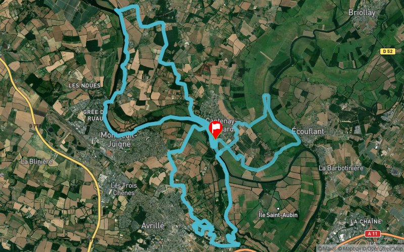


71.7 km
700 m
700 m
 Cantenay-Épinard (49)
 Cantenay-Épinard (49)
 Points of Interest table
| Accum. | Intermediary | |||||||
|---|---|---|---|---|---|---|---|---|
| POI | Description | Alt. | Dist. | D+ | D- | Dist. | D+ | D- |
 Competition organized on 06/20/2021
Trace n°54869
Ascent threshold : 0 m Distance threshold : 30 m Smoothing : Yes Origin of altitudes : MNT IGN
Ascent threshold : 0 m Distance threshold : 30 m Smoothing : Yes Origin of altitudes : MNT IGN
Loop
Dominant terrain : Path
Max alti. : 60 m
Avg alti. : 27 m
Min alti. : 15 m
Longest ascent : 80 m
Longest descent : 50 m
Dominant terrain : Path
Max alti. : 60 m
Avg alti. : 27 m
Min alti. : 15 m
Longest ascent : 80 m
Longest descent : 50 m
Elevation profile
More tools
Create a new roadbook page
Map and track on your website
Warning ! When you insert a Trace de Trail map on your website, you agree not to hide any element of the module (links to Trail Trail or Trail Connect banner)
Add a realisation
Validate
Add a realisation to share your chrono and describe the conditions that you encountered during you trail running !
Add a comment
Validate
Admin - Trace de Trail
09/11/19, 21:59:14
Bonjour, Merci de créer une nouvelle trace pour l'édition 2020 de votre compétition.
09/11/19, 21:59:14
Bonjour, Merci de créer une nouvelle trace pour l'édition 2020 de votre compétition.
Admin - Trace de Trail
28/08/19, 18:05:32
Bonjour, Merci de classer votre trace en compétition avant de la placer en public.
28/08/19, 18:05:32
Bonjour, Merci de classer votre trace en compétition avant de la placer en public.
Show the infos
Add a track


