Show the map
Certified Track - ITRA
Orobie Ultra-Trail® 2018


 Clusone (IT)
 Colognola Al Piano (IT)


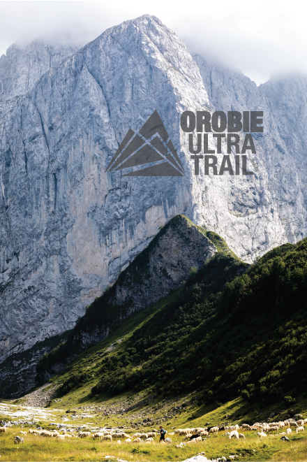
At the end of july, a central point of South Europe, near to Switzerland, France and Austria, with great flight connections between most important European City thanks to the 3rd airport in Italy for flights and passengers, it will be shown, with its beautiful and varied landscapes, a new adventure in the Ultra-Trail® and Trail competitions range: Orobie Ultra-Trail®.
From Alpine Uprightness of Presolana Massif, passing through many prealps lakes of Valle Seriana and Valle Brembana, arriving to the hills of "Città Alta" of Bergamo - surrounded by walls of the sixteenth century, Orobie Ultra-Trail® (OUT) competition will develop on a track of 140 km and 9500 meters of total ascent, connected to a competition of medium distance, Gran Trail Orobie (GTO), with a track of 70 km and 4200 meters of total ascent.
And for those who want to make the first steps in the world of Trail Running there is Bergamo Urban Trail: 20 km between woods and trails around the Venetian Walls of the city of Bergamo, UNESCO heritage.
Points of Interest table
| Accum. | Intermediary | |||||||
|---|---|---|---|---|---|---|---|---|
| POI | Description | Alt. | Dist. | D+ | D- | Dist. | D+ | D- |
 Competition organized on 07/27/2018
Trace n°54704
Ascent threshold : 3 m Distance threshold : 30 m Smoothing : Yes Origin of altitudes : MNT Google
Ascent threshold : 3 m Distance threshold : 30 m Smoothing : Yes Origin of altitudes : MNT Google
Crossing
Dominant terrain : Footpath
Max alti. : 2511 m
Avg alti. : 1512 m
Min alti. : 297 m
Longest ascent : 1500 m
Longest descent : 1200 m
Dominant terrain : Footpath
Max alti. : 2511 m
Avg alti. : 1512 m
Min alti. : 297 m
Longest ascent : 1500 m
Longest descent : 1200 m
Elevation profile
More tools
Create a new roadbook page
Map and track on your website
Warning ! When you insert a Trace de Trail map on your website, you agree not to hide any element of the module (links to Trail Trail or Trail Connect banner)
Add a realisation
Validate
Add a realisation to share your chrono and describe the conditions that you encountered during you trail running !
Add a comment
Validate
Show the infos
Add a track


