Show the map
Certified Track - ITRA
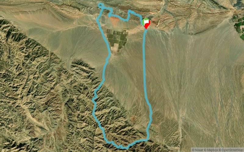
Devil's Ridge 2018 - 60 km


 Inconnu (CN)


Devil's Ridge will take runners through stunning sand canyons, past an inactive volcano, straight towards the high snow-capped peaks in the distance. Comparatively moderate elevation gain is more than made up for by the relentless desert heat, continuous exposure to elements, and technical trail sections. All runnable, not all easy. Pure desert grit.
Points of Interest table
| Accum. | Intermediary | |||||||
|---|---|---|---|---|---|---|---|---|
| POI | Description | Alt. | Dist. | D+ | D- | Dist. | D+ | D- |
 Competition organized on 08/11/2018
Trace n°53688
Ascent threshold : 3 m Distance threshold : 0 m Smoothing : No Origin of altitudes : GPS + MNT Aster GDEM
Ascent threshold : 3 m Distance threshold : 0 m Smoothing : No Origin of altitudes : GPS + MNT Aster GDEM
Loop
Dominant terrain : Path
Max alti. : 3246 m
Avg alti. : 2172 m
Min alti. : 1757 m
Longest ascent : 1600 m
Longest descent : 1480 m
Dominant terrain : Path
Max alti. : 3246 m
Avg alti. : 2172 m
Min alti. : 1757 m
Longest ascent : 1600 m
Longest descent : 1480 m
Elevation profile
More tools
Create a new roadbook page
Map and track on your website
Warning ! When you insert a Trace de Trail map on your website, you agree not to hide any element of the module (links to Trail Trail or Trail Connect banner)
Add a realisation
Validate
Add a realisation to share your chrono and describe the conditions that you encountered during you trail running !
Add a comment
Validate
Show the infos
Add a track


