Show the map
Trail du Loup Blanc 2014
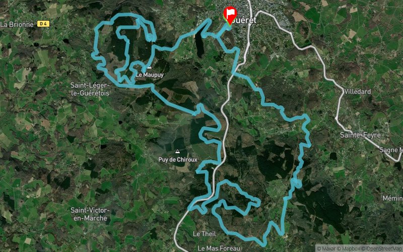


45.1 km
1523 m
1534 m
 Guéret (23)
 Guéret (23)
 Points of Interest table
| Accum. | Intermediary | |||||||
|---|---|---|---|---|---|---|---|---|
| POI | Description | Alt. | Dist. | D+ | D- | Dist. | D+ | D- |
 Competition organized on 12/14/2014
Trace n°5329
Ascent threshold : 0 m Distance threshold : 35 m Smoothing : Yes Origin of altitudes : MNT Aster GDEM
Ascent threshold : 0 m Distance threshold : 35 m Smoothing : Yes Origin of altitudes : MNT Aster GDEM
Loop
Dominant terrain : Footpath
Max alti. : 680 m
Avg alti. : 586 m
Min alti. : 448 m
Longest ascent : 260 m
Longest descent : 208 m
Dominant terrain : Footpath
Max alti. : 680 m
Avg alti. : 586 m
Min alti. : 448 m
Longest ascent : 260 m
Longest descent : 208 m
Elevation profile
More tools
Create a new roadbook page
Map and track on your website
Warning ! When you insert a Trace de Trail map on your website, you agree not to hide any element of the module (links to Trail Trail or Trail Connect banner)
Add a realisation
Validate
Add a realisation to share your chrono and describe the conditions that you encountered during you trail running !
Add a comment
Validate
ecover
18/12/14, 12:07:32
il s'agit de la trace le jour de la compétition : des sentiers se situent sur des zones privées et/ou protégées accessibles uniquement ce jour : cette trace n'a qu'un but informatif sur le dénivelé et le visuel satellitaire
18/12/14, 12:07:32
il s'agit de la trace le jour de la compétition : des sentiers se situent sur des zones privées et/ou protégées accessibles uniquement ce jour : cette trace n'a qu'un but informatif sur le dénivelé et le visuel satellitaire
Show the infos
Add a track


