Show the map
Hard Trail Monte da Padela 2018


 (PT)
(PT) (PT)
(PT)
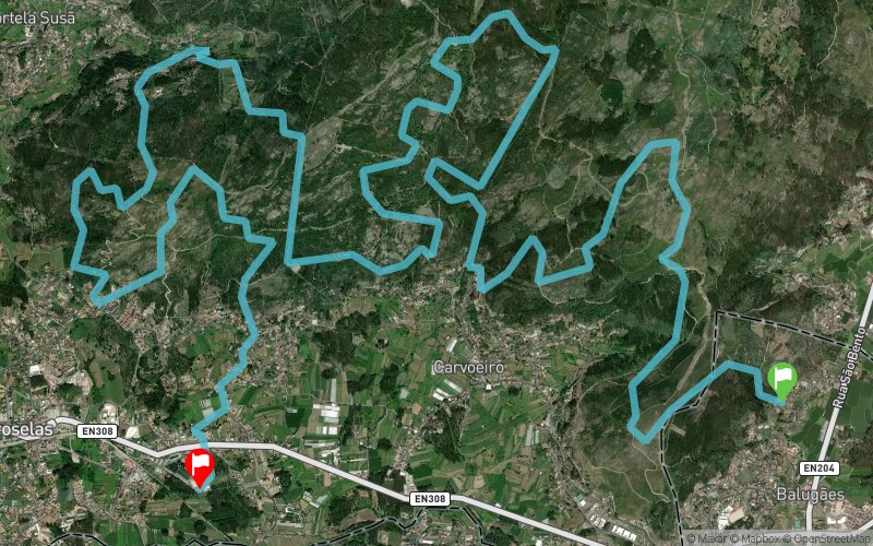
Trail running race with distance of 25km, non circular route, with D + 1800m.
Almost completely in mountain, with the 6th edition of the Uphill, a timed climb with it's own award.
This year with the partnership of Compressport and evaluation test for integration of the National Skyrunning Championship.
Points of Interest table
| Accum. | Intermediary | |||||||
|---|---|---|---|---|---|---|---|---|
| POI | Description | Alt. | Dist. | D+ | D- | Dist. | D+ | D- |
 Competition organized on 06/03/2018
Trace n°53262
Ascent threshold : 3 m Distance threshold : 0 m Smoothing : No Origin of altitudes : GPS + MNT Aster GDEM
Ascent threshold : 3 m Distance threshold : 0 m Smoothing : No Origin of altitudes : GPS + MNT Aster GDEM
Crossing
Dominant terrain : Path
Max alti. : 443 m
Avg alti. : 279 m
Min alti. : 61 m
Longest ascent : 280 m
Longest descent : 330 m
Dominant terrain : Path
Max alti. : 443 m
Avg alti. : 279 m
Min alti. : 61 m
Longest ascent : 280 m
Longest descent : 330 m
Elevation profile
More tools
Create a new roadbook page
Map and track on your website
Warning ! When you insert a Trace de Trail map on your website, you agree not to hide any element of the module (links to Trail Trail or Trail Connect banner)
Add a realisation
Validate
Add a realisation to share your chrono and describe the conditions that you encountered during you trail running !
Add a comment
Validate
Show the infos
Add a track


