

 Revel (38)
| Accum. | Intermediary | |||||||
|---|---|---|---|---|---|---|---|---|
| POI | Description | Alt. | Dist. | D+ | D- | Dist. | D+ | D- |
Ascent threshold : 5 m Distance threshold : 5 m Smoothing : Yes Origin of altitudes : MNT Aster GDEM
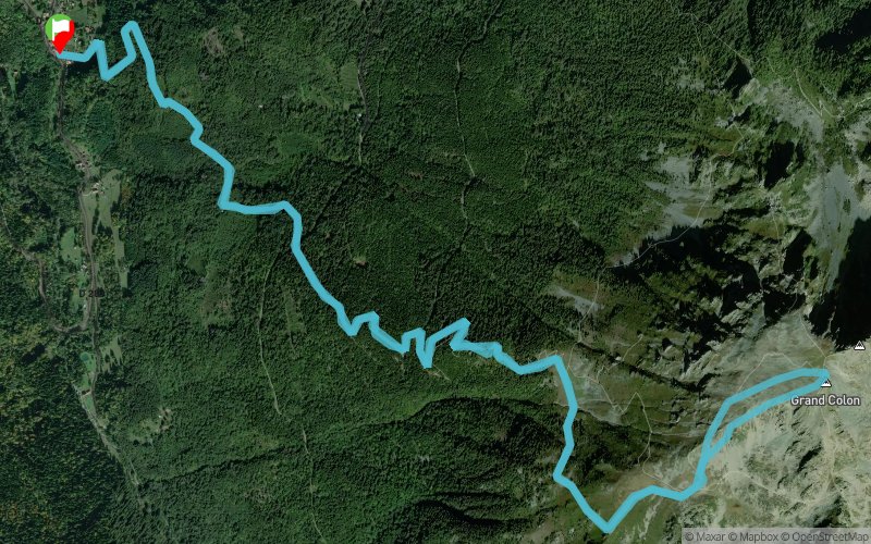
Dominant terrain : Footpath
Max alti. : 2370 m
Avg alti. : 1472 m
Min alti. : 770 m
Longest ascent : 1604 m
Longest descent : 1610 m
Route completed by the author : nc
Warning ! When you insert a Trace de Trail map on your website, you agree not to hide any element of the module (links to Trail Trail or Trail Connect banner)
16/12/14, 21:43:09
Belle course bien diversifiée (forêt de feuillus sur chemin forestier, puis sapinière à travers bois puis retour sur le sentier du Gd Colon, un petit bout d'alpage puis fin dans la caillasse).
Le dénivellé est progressif, jamais négatif dans la montée (ici, quand on monte, on monte!).
Possibilité de tracer encore plus direct dans la face Ouest du Grand Colon (je n'ai pas pu pour cause de neige), le parcours devient alors très Direct (objectif recherché).
Rien de trop cassant, ça déroule mais parfois ça grimpe fort. Un peu d'aventure dans le 2e tiers (dans la forêt), mais rien de bien difficile et on croise tous les 100m de dénivellé, comme des isoplèthes, un chemin forestier horizontal. Impossible de se perdre en somme, et les arbres sont peu denses.


