Show the map
OFFICIAL ROUTE
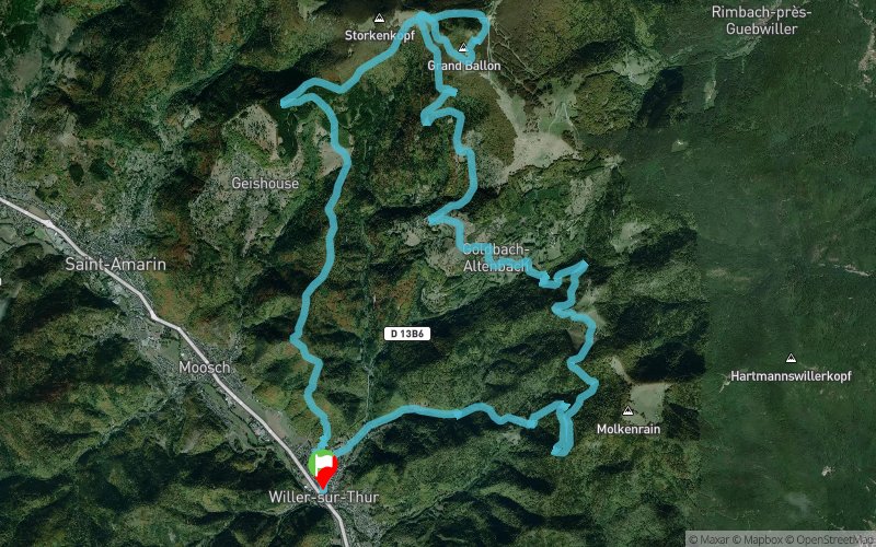
Defi du Grand Ballon 2021 - 32 km


31.6 km
1810 m
1810 m
 Willer-sur-Thur (68)
 Points of Interest table
| Accum. | Intermediary | |||||||
|---|---|---|---|---|---|---|---|---|
| POI | Description | Alt. | Dist. | D+ | D- | Dist. | D+ | D- |
 Competition organized on 08/29/2021
Trace n°52623
Ascent threshold : 0 m Distance threshold : 30 m Smoothing : Yes Origin of altitudes : MNT Aster GDEM
Ascent threshold : 0 m Distance threshold : 30 m Smoothing : Yes Origin of altitudes : MNT Aster GDEM
Loop
Dominant terrain : Footpath
Max alti. : 1414 m
Avg alti. : 838 m
Min alti. : 374 m
Longest ascent : 690 m
Longest descent : 1220 m
Dominant terrain : Footpath
Max alti. : 1414 m
Avg alti. : 838 m
Min alti. : 374 m
Longest ascent : 690 m
Longest descent : 1220 m
Elevation profile
More tools
Create a new roadbook page
Map and track on your website
Warning ! When you insert a Trace de Trail map on your website, you agree not to hide any element of the module (links to Trail Trail or Trail Connect banner)
Add a realisation
Validate
Add a realisation to share your chrono and describe the conditions that you encountered during you trail running !
Add a comment
Validate
Admin - Trace de Trail
13/12/18, 06:08:20
Bonjour, Merci de classer votre trace en compétition avant de la placer en public.
13/12/18, 06:08:20
Bonjour, Merci de classer votre trace en compétition avant de la placer en public.
Show the infos
Add a track


