Show the map
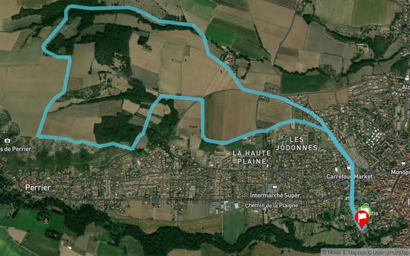
Ruisseau de Boulade - Les Magnaux


10.7 km
670 m
220 m


Points of Interest table
Accum. | Intermediary | |||||||
---|---|---|---|---|---|---|---|---|
POI | Description | Alt. | Dist. | D+ | D- | Dist. | D+ | D- |
Trace n°52607
Ascent threshold : 10 m Distance threshold : 0 m Smoothing : No Origin of altitudes : TrailConnect Android - GPS
Loop
Dominant terrain : Path
Max alti. : 647 m
Avg alti. : 520 m
Min alti. : 445 m
Longest ascent : 660 m
Longest descent : 20 m
Route completed by the author : nc
Dominant terrain : Path
Max alti. : 647 m
Avg alti. : 520 m
Min alti. : 445 m
Longest ascent : 660 m
Longest descent : 20 m
Route completed by the author : nc
Elevation profile

Their last tracks
Puy de Champgourdeix - Puy Ferrand - Puy de Sancy - Puy des Crebasses
18.6 km
1060 m
1040 m
Chambon-sur-Lac (63)
More tools
Create a new roadbook page
Carte à la Carte IGN
Map and track on your website
Warning ! When you insert a Trace de Trail map on your website, you agree not to hide any element of the module (links to Trail Trail or Trail Connect banner)
Add a realisation
Validate
Add a realisation to share your chrono and describe the conditions that you encountered during you trail running !

Add a comment
Validate
Nearby tracks
14.7 km Bois de la Valette - St-Étienne-sur-Usson - Salamot - Ventre
36.8 km
1560 m
1560 m
Sauxillanges (63)
Show the infos
Add a track