Show the map
Col d'Ijou - Roche Ronde - Col de Carlong - La Cousteille
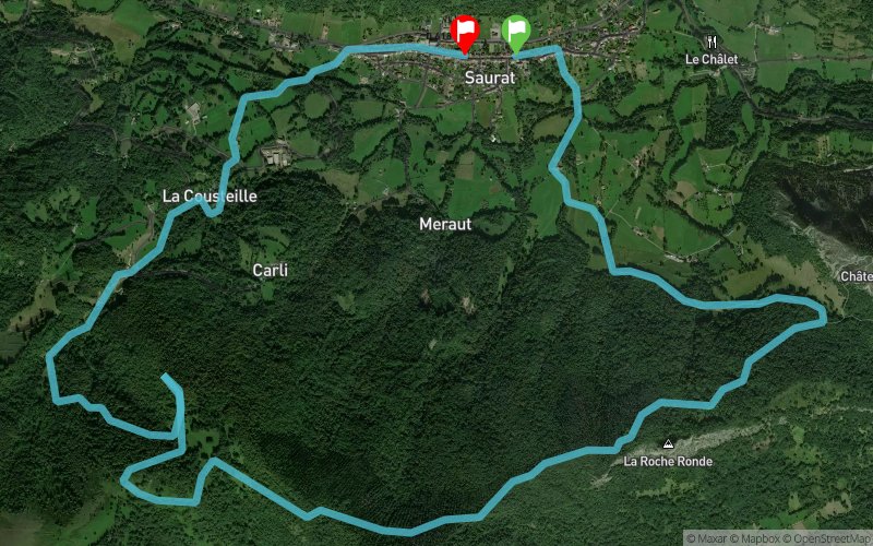


10.7 km
610 m
610 m
 Saurat (09)
 Saurat (09)
 Points of Interest table
| Accum. | Intermediary | |||||||
|---|---|---|---|---|---|---|---|---|
| POI | Description | Alt. | Dist. | D+ | D- | Dist. | D+ | D- |
Trace n°51687
Ascent threshold : 3 m Distance threshold : 30 m Smoothing : Yes Origin of altitudes : MNT Aster GDEM
Ascent threshold : 3 m Distance threshold : 30 m Smoothing : Yes Origin of altitudes : MNT Aster GDEM
Loop
Dominant terrain : Footpath
Max alti. : 1171 m
Avg alti. : 878 m
Min alti. : 635 m
Longest ascent : 550 m
Longest descent : 450 m
Route completed by the author : nc
Dominant terrain : Footpath
Max alti. : 1171 m
Avg alti. : 878 m
Min alti. : 635 m
Longest ascent : 550 m
Longest descent : 450 m
Route completed by the author : nc
Elevation profile
More tools
Create a new roadbook page
Map and track on your website
Warning ! When you insert a Trace de Trail map on your website, you agree not to hide any element of the module (links to Trail Trail or Trail Connect banner)
Add a realisation
Validate
Add a realisation to share your chrono and describe the conditions that you encountered during you trail running !
Add a comment
Validate
vo2max09
27/01/18, 15:39:19
L'aller retour à Carlong est normal, c'est pour aller jusqu'au fameux rocher. A partir de là, on quitte le sentier balisé pour descendre vers Caillardé, le sentier entretenu par les riverains et toujours en bon état, il est bcp plus joli que l'itinéraire balisé qui descend sur Carli (piste quad).
Show the infos
Add a track


