Show the map
Col de la Bène - Lapège
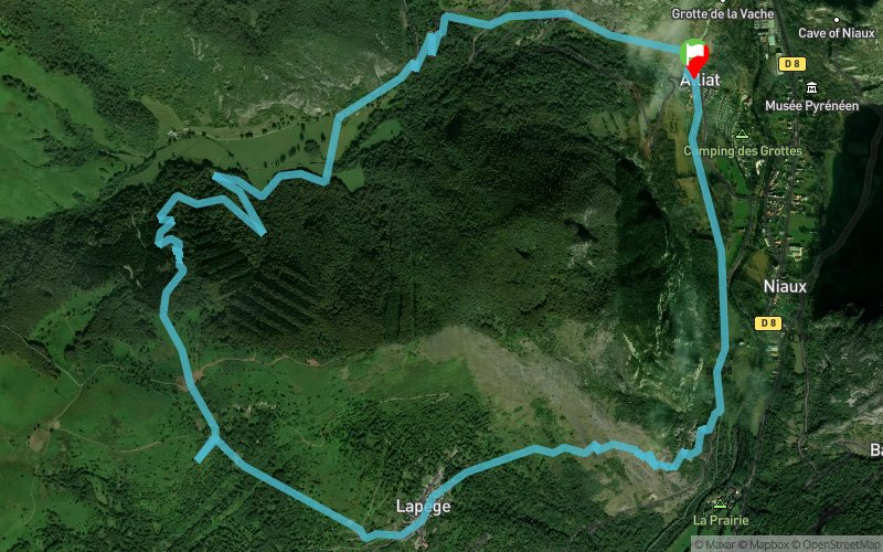


10.9 km
710 m
710 m
 Alliat (09)
 Points of Interest table
| Accum. | Intermediary | |||||||
|---|---|---|---|---|---|---|---|---|
| POI | Description | Alt. | Dist. | D+ | D- | Dist. | D+ | D- |
Trace n°51685
Ascent threshold : 3 m Distance threshold : 30 m Smoothing : Yes Origin of altitudes : MNT Aster GDEM
Ascent threshold : 3 m Distance threshold : 30 m Smoothing : Yes Origin of altitudes : MNT Aster GDEM
Loop
Dominant terrain : Footpath
Max alti. : 1229 m
Avg alti. : 870 m
Min alti. : 542 m
Longest ascent : 660 m
Longest descent : 680 m
Route completed by the author : nc
Dominant terrain : Footpath
Max alti. : 1229 m
Avg alti. : 870 m
Min alti. : 542 m
Longest ascent : 660 m
Longest descent : 680 m
Route completed by the author : nc
Elevation profile
More tools
Create a new roadbook page
Map and track on your website
Warning ! When you insert a Trace de Trail map on your website, you agree not to hide any element of the module (links to Trail Trail or Trail Connect banner)
Add a realisation
Validate
Add a realisation to share your chrono and describe the conditions that you encountered during you trail running !
Add a comment
Validate
vo2max09
27/01/18, 15:35:03
Tout sur sentier balisé. (enlever sur la trace le petit aller retour sous le col de la Bene, on s'était trompé)
27/01/18, 15:35:03
Tout sur sentier balisé. (enlever sur la trace le petit aller retour sous le col de la Bene, on s'était trompé)
Show the infos
Add a track


