Show the map
Certified Track - ITRA
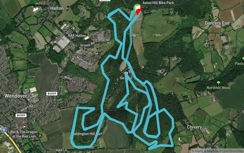
Wendover Woods 50 2018


 Aston Clinton (GB)


THE WW50 IS A 50 MILE FOOT RACE CONSISTING OF 5 X 10 MILE LOOPS ON FOREST TRAILS, ENTIRELY WITHIN WENDOVER WOODS. THE COURSE MIXES SOME OF THE MOST ENJOYABLE TRAIL RUNNING TO BE FOUND ANYWHERE, WITH WIDE, SOFT TRAILS INCLUDING SMOOTH DESCENTS AND RUNNABLE CLIMBS. THESE SECTIONS ARE CONTRASTED WITH SOME MUCH STEEPER ASCENTS AND DESCENTS SCATTERED THROUGHOUT THE LOOP. RUNNERS WILL WORK HARD FOR A FINISH AT THIS RACE WHICH WILL ALSO ACT AS THE FOURTH AND FINAL EVENT IN THE 2018 50 MILE SLAM.
Points of Interest table
| Accum. | Intermediary | |||||||
|---|---|---|---|---|---|---|---|---|
| POI | Description | Alt. | Dist. | D+ | D- | Dist. | D+ | D- |
 Competition organized on 11/17/2018
Trace n°51558
Ascent threshold : 3 m Distance threshold : 0 m Smoothing : No Origin of altitudes : GPS
Ascent threshold : 3 m Distance threshold : 0 m Smoothing : No Origin of altitudes : GPS
Loop
Dominant terrain : Footpath
Max alti. : 268 m
Avg alti. : 214 m
Min alti. : 157 m
Longest ascent : 120 m
Longest descent : 100 m
Dominant terrain : Footpath
Max alti. : 268 m
Avg alti. : 214 m
Min alti. : 157 m
Longest ascent : 120 m
Longest descent : 100 m
Elevation profile
More tools
Create a new roadbook page
Map and track on your website
Warning ! When you insert a Trace de Trail map on your website, you agree not to hide any element of the module (links to Trail Trail or Trail Connect banner)
Add a realisation
Validate
Add a realisation to share your chrono and describe the conditions that you encountered during you trail running !
Add a comment
Validate
Show the infos
Add a track


