Show the map
Col de Barmerousse - Chalets de Platé
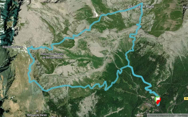


12.5 km
1386 m
1393 m
 Servoz (74)
 Points of Interest table
| Accum. | Intermediary | |||||||
|---|---|---|---|---|---|---|---|---|
| POI | Description | Alt. | Dist. | D+ | D- | Dist. | D+ | D- |
Trace n°4897
Ascent threshold : 0 m Distance threshold : 35 m Smoothing : Yes Origin of altitudes : MNT Aster GDEM
Ascent threshold : 0 m Distance threshold : 35 m Smoothing : Yes Origin of altitudes : MNT Aster GDEM
Loop
Dominant terrain : Footpath
Max alti. : 2312 m
Avg alti. : 1768 m
Min alti. : 1178 m
Longest ascent : 1334 m
Longest descent : 990 m
Route completed by the author : nc
Dominant terrain : Footpath
Max alti. : 2312 m
Avg alti. : 1768 m
Min alti. : 1178 m
Longest ascent : 1334 m
Longest descent : 990 m
Route completed by the author : nc
Elevation profile
More tools
Create a new roadbook page
Map and track on your website
Warning ! When you insert a Trace de Trail map on your website, you agree not to hide any element of the module (links to Trail Trail or Trail Connect banner)
Add a realisation
Validate
Add a realisation to share your chrono and describe the conditions that you encountered during you trail running !
Add a comment
Validate
fabiennoel
02/11/14, 14:36:01
Départ Praz Coutant ( après le plateau D'Assy ) , Charbonniere , Frioland , Aiguille de Varan , Chalet de Barmerousse , Refuge de Platé , retour parking de Praz Coutant
02/11/14, 14:36:01
Départ Praz Coutant ( après le plateau D'Assy ) , Charbonniere , Frioland , Aiguille de Varan , Chalet de Barmerousse , Refuge de Platé , retour parking de Praz Coutant
fabiennoel
02/11/14, 14:27:38
Départ Praz Coutant , Charbonniere , Frioland , Aiguille de Varan , Chalet de Barmerousse , Refuge de Platé , Praz Coutant
02/11/14, 14:27:38
Départ Praz Coutant , Charbonniere , Frioland , Aiguille de Varan , Chalet de Barmerousse , Refuge de Platé , Praz Coutant
Show the infos
Add a track


