Show the map
Les Valettes - Combe de Bursins - Les Vaux - Vincy
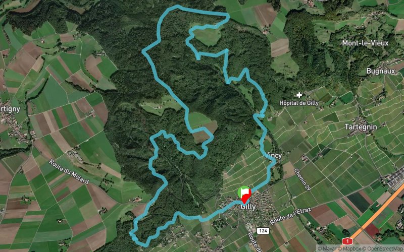


13 km
530 m
540 m
 Gilly (CH)
 Points of Interest table
| Accum. | Intermediary | |||||||
|---|---|---|---|---|---|---|---|---|
| POI | Description | Alt. | Dist. | D+ | D- | Dist. | D+ | D- |
Trace n°46484
Ascent threshold : 3 m Distance threshold : 30 m Smoothing : Yes Origin of altitudes : MNT Aster GDEM
Ascent threshold : 3 m Distance threshold : 30 m Smoothing : Yes Origin of altitudes : MNT Aster GDEM
Loop
Dominant terrain : Path
Max alti. : 905 m
Avg alti. : 687 m
Min alti. : 486 m
Longest ascent : 230 m
Longest descent : 240 m
Route completed by the author : nc
Dominant terrain : Path
Max alti. : 905 m
Avg alti. : 687 m
Min alti. : 486 m
Longest ascent : 230 m
Longest descent : 240 m
Route completed by the author : nc
Elevation profile
More tools
Create a new roadbook page
Map and track on your website
Warning ! When you insert a Trace de Trail map on your website, you agree not to hide any element of the module (links to Trail Trail or Trail Connect banner)
Add a realisation
Validate
Add a realisation to share your chrono and describe the conditions that you encountered during you trail running !
Add a comment
Validate
acperrin
16/11/19, 14:34:27
La montée est super et le tour bien équilibré. Par contre, la trace à la descente pose problème : passage au milieu d'une grande propriété privée avec 3 chiens et 2x sentiers qui ne sont plus marqués et difficilement praticables ( ronces etc)
16/11/19, 14:34:27
La montée est super et le tour bien équilibré. Par contre, la trace à la descente pose problème : passage au milieu d'une grande propriété privée avec 3 chiens et 2x sentiers qui ne sont plus marqués et difficilement praticables ( ronces etc)
Show the infos
Add a track


