Show the map
Evaluated Track - ITRA
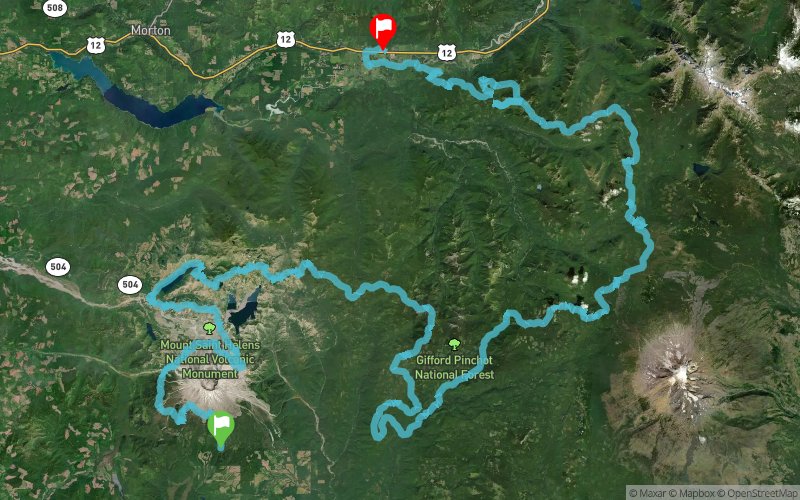
Bigfoot Endurance Runs 2017 - Bigfoot 200


 Cougar (US)
 Randle (US)


The Bigfoot 200 is the first ever point to point 200+ mile race in the United States. The Bigfoot 200 is completely original from start to finish. Runners will explore such varied terrain as the otherworldly Volcanic Mount St. Helens (erupted in 1980), long mountaintop ridge lines with stunning forest, mountain and lake views, deep old growth forests as green and thick as a rainforest, misty mountain tops, cross countless streams and rivers and finally a long ridge line with views of the most massive mountains in the Cascade Range and into Randle, WA on their way to completing this massive, life changing event.
Points of Interest table
| Accum. | Intermediary | |||||||
|---|---|---|---|---|---|---|---|---|
| POI | Description | Alt. | Dist. | D+ | D- | Dist. | D+ | D- |
 Competition organized on 08/11/2017
Trace n°43945
Ascent threshold : 3 m Distance threshold : 30 m Smoothing : Yes Origin of altitudes : MNT Google
Ascent threshold : 3 m Distance threshold : 30 m Smoothing : Yes Origin of altitudes : MNT Google
Crossing
Dominant terrain : Footpath
Max alti. : 1777 m
Avg alti. : 1160 m
Min alti. : 266 m
Longest ascent : 1200 m
Longest descent : 1530 m
Dominant terrain : Footpath
Max alti. : 1777 m
Avg alti. : 1160 m
Min alti. : 266 m
Longest ascent : 1200 m
Longest descent : 1530 m
Elevation profile
More tools
Create a new roadbook page
Map and track on your website
Warning ! When you insert a Trace de Trail map on your website, you agree not to hide any element of the module (links to Trail Trail or Trail Connect banner)
Add a realisation
Validate
Add a realisation to share your chrono and describe the conditions that you encountered during you trail running !
Add a comment
Validate
Show the infos
Add a track


