Show the map
Le Malpassant - Pragondran - Croix du Nivolet - Le Sire
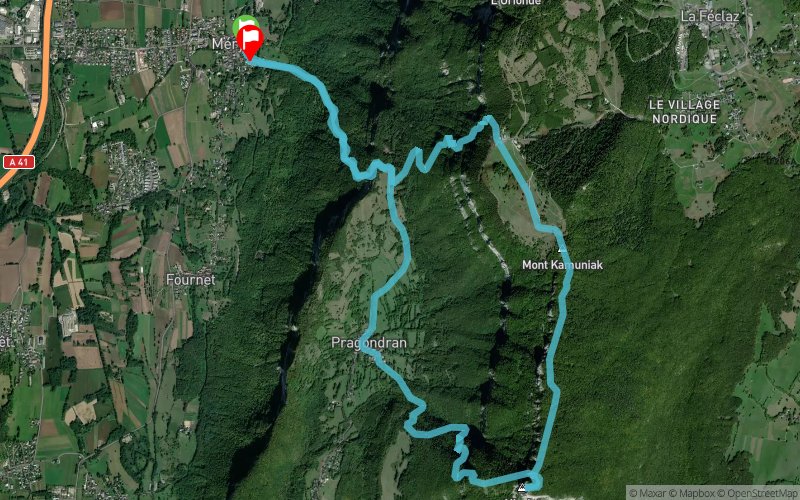


13.5 km
1410 m
1400 m
 Méry (73)
 Méry (73)
 Points of Interest table
| Accum. | Intermediary | |||||||
|---|---|---|---|---|---|---|---|---|
| POI | Description | Alt. | Dist. | D+ | D- | Dist. | D+ | D- |
Trace n°4339
Ascent threshold : 3 m Distance threshold : 30 m Smoothing : Yes Origin of altitudes : MNT IGN
Ascent threshold : 3 m Distance threshold : 30 m Smoothing : Yes Origin of altitudes : MNT IGN
Loop
Dominant terrain : Footpath
Max alti. : 1552 m
Avg alti. : 1035 m
Min alti. : 380 m
Longest ascent : 810 m
Longest descent : 1170 m
Route completed by the author : Yes
Dominant terrain : Footpath
Max alti. : 1552 m
Avg alti. : 1035 m
Min alti. : 380 m
Longest ascent : 810 m
Longest descent : 1170 m
Route completed by the author : Yes
Elevation profile
More tools
Create a new roadbook page
Map and track on your website
Warning ! When you insert a Trace de Trail map on your website, you agree not to hide any element of the module (links to Trail Trail or Trail Connect banner)
Add a realisation
Validate
Add a realisation to share your chrono and describe the conditions that you encountered during you trail running !
Add a comment
Validate
pauloTrail
10/07/21, 18:46:50
Le temps est de 3h10...j'arrive pas à corriger. Le tour passe à 16kms pour 1500 de D+
10/07/21, 18:46:50
Le temps est de 3h10...j'arrive pas à corriger. Le tour passe à 16kms pour 1500 de D+
Show the infos
Add a track


