Show the map
Gourette - Lac d'Uzious - Col d'Uzious - Sanctus
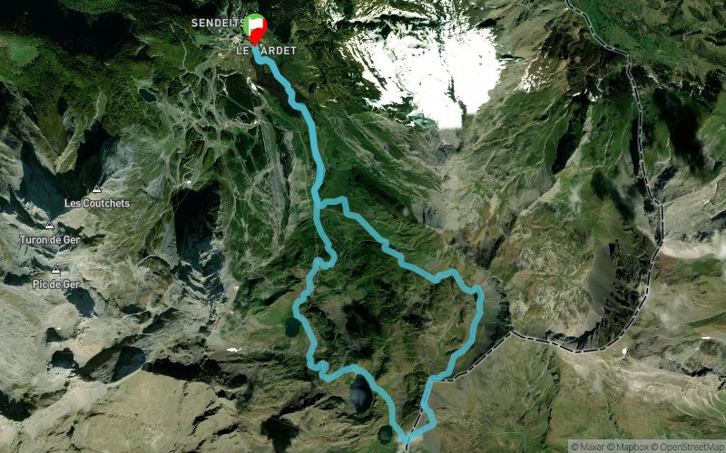


 Eaux-Bonnes (64)
 Points of Interest table
| Accum. | Intermediary | |||||||
|---|---|---|---|---|---|---|---|---|
| POI | Description | Alt. | Dist. | D+ | D- | Dist. | D+ | D- |
Trace n°43124
Ascent threshold : 3 m Distance threshold : 30 m Smoothing : Yes Origin of altitudes : MNT Aster GDEM
Ascent threshold : 3 m Distance threshold : 30 m Smoothing : Yes Origin of altitudes : MNT Aster GDEM
Loop
Dominant terrain : Footpath
Max alti. : 2451 m
Avg alti. : 1910 m
Min alti. : 1341 m
Longest ascent : 700 m
Longest descent : 1110 m
Route completed by the author : Yes
Dominant terrain : Footpath
Max alti. : 2451 m
Avg alti. : 1910 m
Min alti. : 1341 m
Longest ascent : 700 m
Longest descent : 1110 m
Route completed by the author : Yes
Elevation profile
More tools
Create a new roadbook page
Map and track on your website
Warning ! When you insert a Trace de Trail map on your website, you agree not to hide any element of the module (links to Trail Trail or Trail Connect banner)
Add a realisation
Validate
Add a realisation to share your chrono and describe the conditions that you encountered during you trail running !
Add a comment
Validate
Le-Bouquetin-Boiteux
26/08/17, 15:04:25
Plus d'infos ici : http://gump-blog.blogspot.fr/2017/08/pic-sanctus-gourette-en-boucle.html
26/08/17, 15:04:25
Plus d'infos ici : http://gump-blog.blogspot.fr/2017/08/pic-sanctus-gourette-en-boucle.html
Show the infos
Add a track


