Show the map
Le Heaulme - Buttes de Rosné - Chavençon - Bois du Caillouet
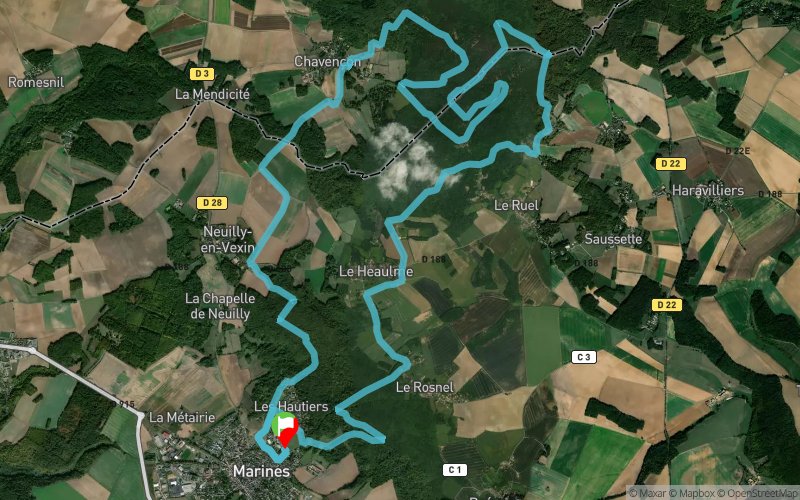


24.7 km
677 m
682 m
 Marines (95)
 Points of Interest table
| Accum. | Intermediary | |||||||
|---|---|---|---|---|---|---|---|---|
| POI | Description | Alt. | Dist. | D+ | D- | Dist. | D+ | D- |
Trace n°41270
Ascent threshold : 3 m Distance threshold : 30 m Smoothing : Yes Origin of altitudes : MNT Aster GDEM
Ascent threshold : 3 m Distance threshold : 30 m Smoothing : Yes Origin of altitudes : MNT Aster GDEM
Loop
Dominant terrain : Footpath
Max alti. : 231 m
Avg alti. : 170 m
Min alti. : 113 m
Longest ascent : 120 m
Longest descent : 110 m
Route completed by the author : nc
Dominant terrain : Footpath
Max alti. : 231 m
Avg alti. : 170 m
Min alti. : 113 m
Longest ascent : 120 m
Longest descent : 110 m
Route completed by the author : nc
Elevation profile
More tools
Create a new roadbook page
Map and track on your website
Warning ! When you insert a Trace de Trail map on your website, you agree not to hide any element of the module (links to Trail Trail or Trail Connect banner)
Add a realisation
Validate
Add a realisation to share your chrono and describe the conditions that you encountered during you trail running !
Add a comment
Validate
jochim75
28/06/21, 11:26:55
Fait hier - jolie sortie vallonnée et ombragée Commentaires sur la trace: 1/ Sections fermée aux piétons - km 11.3 - 13.2 2/ Pas possible de remonter à droite au km 15 (sf en mode "Barkley" ;-)), mais possible de continuer tout droit et rejoindre le tracé au km 17,7 3/ Sur la fin, il faut continuer tout droit au km 21,3 puis tourner à gauche 4/ Il n'est plus possible de descendre vers les Hautiers au km 22,7 (propriété privée cloturée)
Show the infos
Add a track


