
Run and Bike de la Fête du Canal de la Siagne 2017
 12.9 km
550 m
90 m
12.9 km
550 m
90 m
09/09/2017
GPX
31
PDF
Profile
Share
3D
Favorites
Reviews
Like
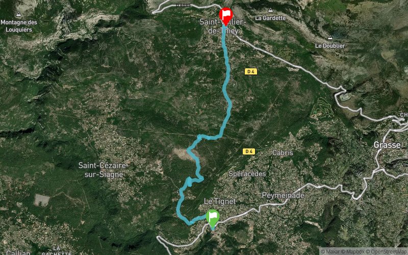
Le Tignet (06) Saint-Vallier-de-Thiey (06)
Effort kilometer
Longest ascent
Longest descent
18
560 m
30 m
Max. elevation
Min. elevation
Quality index
721 m
239 m
 1pt/16m
Start
Distance
0 km
Altitude
244 m
D+
0 m
D-
0 m
12.9 km
549 m
82 m
Finish
Distance
12.9 km
Altitude
718 m
D+
549 m
D-
82 m
Click on a point of interest to display it on the map
Reviews and times
Add a track
Run and Bike de la Fête du Canal de la Siagne 2017

Track number : 39356
Link to track :
https://tracedetrail.fr/en/trace/39356
Log in to insert this track on your website
 Trace de Trail