Show the map
Evaluated Track - ITRA
Wing of Merlin Trail Challenge 2017


 Inconnu (CN)


We will meet the 3rd Station of UTST 2017——Wing of Merlin Trail Challenge—— in May 21st?which is launched and held by Shenzhen Deep Experience Co., Ltd.
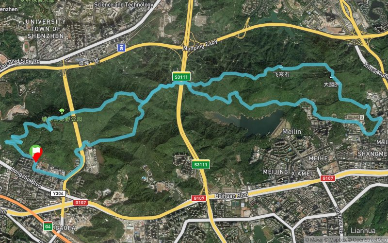
The race starts at Longzhu Middle School, and running through Mount-Tanglang Country Park?Mount-Merlin Park. The track is 25km long and more than 1500m up.
Points of Interest table
| Accum. | Intermediary | |||||||
|---|---|---|---|---|---|---|---|---|
| POI | Description | Alt. | Dist. | D+ | D- | Dist. | D+ | D- |
 Competition organized on 05/21/2017
Trace n°37813
Ascent threshold : 3 m Distance threshold : 30 m Smoothing : Yes Origin of altitudes : MNT Google
Ascent threshold : 3 m Distance threshold : 30 m Smoothing : Yes Origin of altitudes : MNT Google
Loop
Dominant terrain : Footpath
Max alti. : 386 m
Avg alti. : 194 m
Min alti. : 31 m
Longest ascent : 370 m
Longest descent : 280 m
Dominant terrain : Footpath
Max alti. : 386 m
Avg alti. : 194 m
Min alti. : 31 m
Longest ascent : 370 m
Longest descent : 280 m
Elevation profile
More tools
Create a new roadbook page
Map and track on your website
Warning ! When you insert a Trace de Trail map on your website, you agree not to hide any element of the module (links to Trail Trail or Trail Connect banner)
Add a realisation
Validate
Add a realisation to share your chrono and describe the conditions that you encountered during you trail running !
Add a comment
Validate
Show the infos
Add a track


