Show the map
Trail des Glières 2019 - 23 km
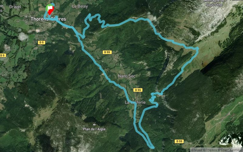


 Thorens-Glières (74)
 Points of Interest table
| Accum. | Intermediary | |||||||
|---|---|---|---|---|---|---|---|---|
| POI | Description | Alt. | Dist. | D+ | D- | Dist. | D+ | D- |
 Competition organized on 10/06/2019
Trace n°36410
Ascent threshold : 3 m Distance threshold : 30 m Smoothing : Yes Origin of altitudes : MNT Aster GDEM
Ascent threshold : 3 m Distance threshold : 30 m Smoothing : Yes Origin of altitudes : MNT Aster GDEM
Crossing
Dominant terrain : Footpath
Max alti. : 1574 m
Avg alti. : 995 m
Min alti. : 654 m
Longest ascent : 660 m
Longest descent : 910 m
Dominant terrain : Footpath
Max alti. : 1574 m
Avg alti. : 995 m
Min alti. : 654 m
Longest ascent : 660 m
Longest descent : 910 m
More tools
Create a new roadbook page
Map and track on your website
Warning ! When you insert a Trace de Trail map on your website, you agree not to hide any element of the module (links to Trail Trail or Trail Connect banner)
Add a realisation
Validate
Add a realisation to share your chrono and describe the conditions that you encountered during you trail running !
Add a comment
Validate
Admin - Trace de Trail
10/06/19, 22:34:52
Bonjour, Merci de modifier votre date de compétition pour l'édition 2019 ou de créer une nouvelle trace, ce qui est préférable...
10/06/19, 22:34:52
Bonjour, Merci de modifier votre date de compétition pour l'édition 2019 ou de créer une nouvelle trace, ce qui est préférable...
Show the infos
Add a track


