Show the map
Mercantour : St Etienne de Tinée - refuge des lacs de Vens
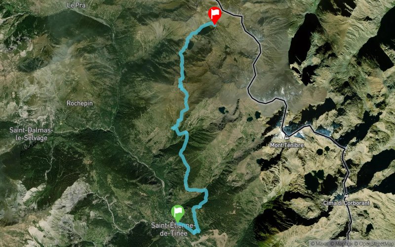


11.7 km
1627 m
411 m
 Saint-Étienne-de-Tinée (06)
 Saint-Dalmas-le-Selvage (06)
 Points of Interest table
| Accum. | Intermediary | |||||||
|---|---|---|---|---|---|---|---|---|
| POI | Description | Alt. | Dist. | D+ | D- | Dist. | D+ | D- |
Trace n°3523
Ascent threshold : 0 m Distance threshold : 35 m Smoothing : Yes Origin of altitudes : MNT Aster GDEM
Ascent threshold : 0 m Distance threshold : 35 m Smoothing : Yes Origin of altitudes : MNT Aster GDEM
Crossing
Dominant terrain : Footpath
Max alti. : 2506 m
Avg alti. : 1955 m
Min alti. : 1139 m
Longest ascent : 955 m
Longest descent : 222 m
Route completed by the author : nc
Dominant terrain : Footpath
Max alti. : 2506 m
Avg alti. : 1955 m
Min alti. : 1139 m
Longest ascent : 955 m
Longest descent : 222 m
Route completed by the author : nc
Elevation profile
More tools
Create a new roadbook page
Map and track on your website
Warning ! When you insert a Trace de Trail map on your website, you agree not to hide any element of the module (links to Trail Trail or Trail Connect banner)
Add a realisation
Validate
Add a realisation to share your chrono and describe the conditions that you encountered during you trail running !
Add a comment
Validate
FMax
06/07/14, 14:41:08
Bon entraînement pour du km vertical, une première montée de 900D+ en 3 km, et la deuxième de plus de 700D+ dans les cailloux en 3km aussi, ça fait mal mais le site est magique ! (et l'assiette de fromage avec la bière au refuge aussi)
06/07/14, 14:41:08
Bon entraînement pour du km vertical, une première montée de 900D+ en 3 km, et la deuxième de plus de 700D+ dans les cailloux en 3km aussi, ça fait mal mais le site est magique ! (et l'assiette de fromage avec la bière au refuge aussi)
Show the infos
Add a track


