Show the map
Evaluated Track - ITRA
Ultra-Trail® Muntanyes De La Costa Daurada 2017 - Long Trail Muntanyes De La Costa Daurada
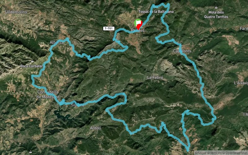


 Prades (ES)


The Long Trail of 72 kms, was born in 2015 and aims to offer one more option to the runners between the Ultra and Half. Undoubtedly, it will not leave you indifferent for its beautiful route, distance and hardness. Departure and arrival to the beautiful village of Prades.
Points of Interest table
| Accum. | Intermediary | |||||||
|---|---|---|---|---|---|---|---|---|
| POI | Description | Alt. | Dist. | D+ | D- | Dist. | D+ | D- |
 Competition organized on 04/29/2017
Trace n°33326
Ascent threshold : 3 m Distance threshold : 30 m Smoothing : Yes Origin of altitudes : MNT Aster GDEM
Ascent threshold : 3 m Distance threshold : 30 m Smoothing : Yes Origin of altitudes : MNT Aster GDEM
Loop
Dominant terrain : Footpath
Max alti. : 1196 m
Avg alti. : 795 m
Min alti. : 346 m
Longest ascent : 640 m
Longest descent : 500 m
Dominant terrain : Footpath
Max alti. : 1196 m
Avg alti. : 795 m
Min alti. : 346 m
Longest ascent : 640 m
Longest descent : 500 m
Elevation profile
More tools
Create a new roadbook page
Map and track on your website
Warning ! When you insert a Trace de Trail map on your website, you agree not to hide any element of the module (links to Trail Trail or Trail Connect banner)
Add a realisation
Validate
Add a realisation to share your chrono and describe the conditions that you encountered during you trail running !
Add a comment
Validate
Show the infos
Add a track


