Show the map
Evaluated Track - ITRA
Bigfoot Endurance Runs 2016 - Bigfoot 100K


 Inconnu (US)
 Cougar (US)


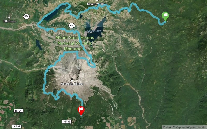
The 100k is also a point to point exploration of the Cascades, from Elk Pass to Mt. St. Helens. Besides the 3 times the course crosses roads, it's ENTIRELY single track trails, that's 99.8%. 14,000 ft ascent / 16,000ft descent / 68.8 miles / starts Saturday, Oct. 8 at 7am / 32hr cut off!
Points of Interest table
| Accum. | Intermediary | |||||||
|---|---|---|---|---|---|---|---|---|
| POI | Description | Alt. | Dist. | D+ | D- | Dist. | D+ | D- |
 Competition organized on 10/08/2016
Trace n°30483
Ascent threshold : 3 m Distance threshold : 30 m Smoothing : Yes Origin of altitudes : MNT Aster GDEM
Ascent threshold : 3 m Distance threshold : 30 m Smoothing : Yes Origin of altitudes : MNT Aster GDEM
Crossing
Dominant terrain : Footpath
Max alti. : 1728 m
Avg alti. : 1191 m
Min alti. : 705 m
Longest ascent : 750 m
Longest descent : 860 m
Dominant terrain : Footpath
Max alti. : 1728 m
Avg alti. : 1191 m
Min alti. : 705 m
Longest ascent : 750 m
Longest descent : 860 m
Elevation profile
More tools
Create a new roadbook page
Map and track on your website
Warning ! When you insert a Trace de Trail map on your website, you agree not to hide any element of the module (links to Trail Trail or Trail Connect banner)
Add a realisation
Validate
Add a realisation to share your chrono and describe the conditions that you encountered during you trail running !
Add a comment
Validate
Show the infos
Add a track


