Show the map
Sainte Victoire 17k
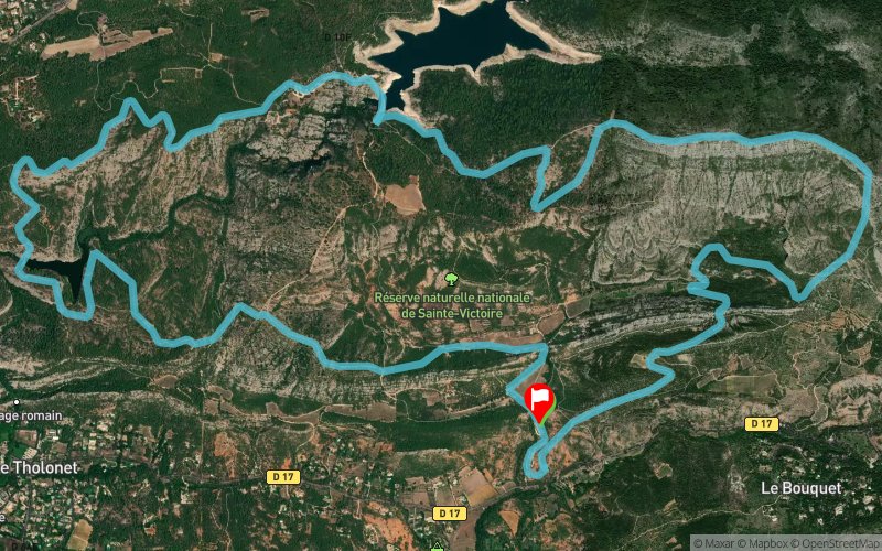


 Beaurecueil (13)
 Beaurecueil (13)
 Points of Interest table
| Accum. | Intermediary | |||||||
|---|---|---|---|---|---|---|---|---|
| POI | Description | Alt. | Dist. | D+ | D- | Dist. | D+ | D- |
Trace n°2742
Ascent threshold : 0 m Distance threshold : 35 m Smoothing : Yes Origin of altitudes : MNT Aster GDEM
Ascent threshold : 0 m Distance threshold : 35 m Smoothing : Yes Origin of altitudes : MNT Aster GDEM
Loop
Dominant terrain : Footpath
Max alti. : 659 m
Avg alti. : 357 m
Min alti. : 224 m
Longest ascent : 358 m
Longest descent : 359 m
Route completed by the author : nc
Dominant terrain : Footpath
Max alti. : 659 m
Avg alti. : 357 m
Min alti. : 224 m
Longest ascent : 358 m
Longest descent : 359 m
Route completed by the author : nc
Elevation profile
More tools
Create a new roadbook page
Map and track on your website
Warning ! When you insert a Trace de Trail map on your website, you agree not to hide any element of the module (links to Trail Trail or Trail Connect banner)
Add a realisation
Validate
Add a realisation to share your chrono and describe the conditions that you encountered during you trail running !
Add a comment
Validate
benoitd
02/08/15, 23:24:08
Trace obsolète. Dès les premiers kilomètres, on est bloqué par un panneau "terrain militaire - passage interdit". Et sur la fin le sentier finit dans un ruisseau avec une grande hauteur de ronces impraticable. Dommage car le tracé est superbe dans l'ensemble !
02/08/15, 23:24:08
Trace obsolète. Dès les premiers kilomètres, on est bloqué par un panneau "terrain militaire - passage interdit". Et sur la fin le sentier finit dans un ruisseau avec une grande hauteur de ronces impraticable. Dommage car le tracé est superbe dans l'ensemble !
Show the infos
Add a track


