Show the map
Boucle autour de Davayé-Chasselas
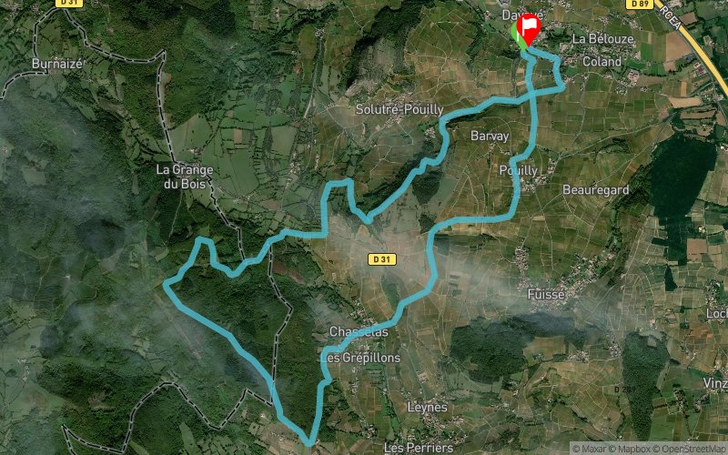


15.3 km
594 m
602 m
 Davayé (71)
 Davayé (71)
 Points of Interest table
| Accum. | Intermediary | |||||||
|---|---|---|---|---|---|---|---|---|
| POI | Description | Alt. | Dist. | D+ | D- | Dist. | D+ | D- |
Trace n°2648
Ascent threshold : 0 m Distance threshold : 35 m Smoothing : Yes Origin of altitudes : MNT Aster GDEM
Ascent threshold : 0 m Distance threshold : 35 m Smoothing : Yes Origin of altitudes : MNT Aster GDEM
Loop
Dominant terrain : Footpath
Max alti. : 559 m
Avg alti. : 378 m
Min alti. : 206 m
Longest ascent : 213 m
Longest descent : 251 m
Route completed by the author : nc
Dominant terrain : Footpath
Max alti. : 559 m
Avg alti. : 378 m
Min alti. : 206 m
Longest ascent : 213 m
Longest descent : 251 m
Route completed by the author : nc
Elevation profile
More tools
Create a new roadbook page
Map and track on your website
Warning ! When you insert a Trace de Trail map on your website, you agree not to hide any element of the module (links to Trail Trail or Trail Connect banner)
Add a realisation
Validate
Add a realisation to share your chrono and describe the conditions that you encountered during you trail running !
Add a comment
Validate
mirnet
04/10/15, 19:01:30
Parcours très sympa, réalisé dans le sens inverse proposé, offre une longue et belle descente à mi parcours. Nombreuses portions boisées. Descente technique apres le mont pouilly. En prime vue sur le massif du mont blanc !
04/10/15, 19:01:30
Parcours très sympa, réalisé dans le sens inverse proposé, offre une longue et belle descente à mi parcours. Nombreuses portions boisées. Descente technique apres le mont pouilly. En prime vue sur le massif du mont blanc !
Show the infos
Add a track


