Show the map
Evaluated Track - ITRA
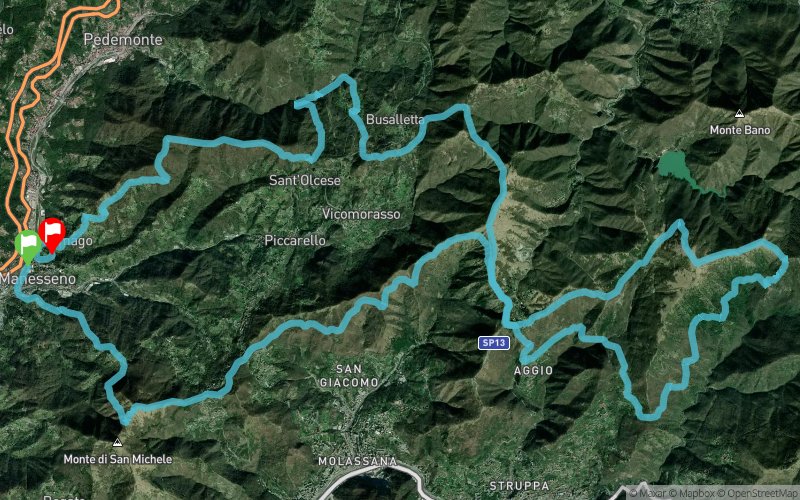
Sant'olcese Trail 2016


 Manesseno (IT)
 Manesseno (IT)


The Sant'Olcese Trail is a competition of 42 km and 2424 D +
The start and finish of the race will be in the beautiful setting of Villa Serra di Comago. A competition that runs along paths and trails overlooking the Ligurian Sea. The race is part of the circuit Strong WILD TRAIL CUP, which groups the main Ligurian competitions.
Points of Interest table
| Accum. | Intermediary | |||||||
|---|---|---|---|---|---|---|---|---|
| POI | Description | Alt. | Dist. | D+ | D- | Dist. | D+ | D- |
 Competition organized on 10/02/2016
Trace n°26175
Ascent threshold : 3 m Distance threshold : 30 m Smoothing : Yes Origin of altitudes : MNT Aster GDEM
Ascent threshold : 3 m Distance threshold : 30 m Smoothing : Yes Origin of altitudes : MNT Aster GDEM
Loop
Dominant terrain : Path
Max alti. : 932 m
Avg alti. : 487 m
Min alti. : 54 m
Longest ascent : 570 m
Longest descent : 500 m
Dominant terrain : Path
Max alti. : 932 m
Avg alti. : 487 m
Min alti. : 54 m
Longest ascent : 570 m
Longest descent : 500 m
Elevation profile
More tools
Create a new roadbook page
Map and track on your website
Warning ! When you insert a Trace de Trail map on your website, you agree not to hide any element of the module (links to Trail Trail or Trail Connect banner)
Add a realisation
Validate
Add a realisation to share your chrono and describe the conditions that you encountered during you trail running !
Add a comment
Validate
Show the infos
Add a track


